Lane to Bradley Green
Introduction
The photograph on this page of Lane to Bradley Green by Derek Harper as part of the Geograph project.
The Geograph project started in 2005 with the aim of publishing, organising and preserving representative images for every square kilometre of Great Britain, Ireland and the Isle of Man.

There are currently over 7.5m images from over 14,400 individuals and you can help contribute to the project by visiting https://www.geograph.org.uk
Lane to Bradley Green
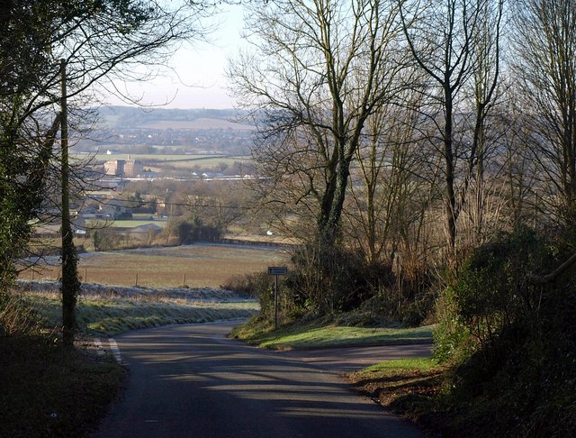
Image: © Derek Harper Taken: 2 Jan 2010
The lane mentioned under Image, sunken and overhung with trees as it drops down the Cotswold scarp from Bradley Road, emerges into the open at a left turn to Corner Farm. Ahead is Image
Images are licensed for reuse under creativecommons.org/licenses/by-sa/2.0
Image Location
Latitude
51.641529
Longitude
-2.366429