IMAGES TAKEN NEAR TO
Quarry Gardens, DURSLEY, GL11 6HW

Introduction

This page details the photographs taken nearby to Quarry Gardens, GL11 6HW by members of the Geograph project.

The Geograph project started in 2005 with the aim of publishing, organising and preserving representative images for every square kilometre of Great Britain, Ireland and the Isle of Man.

There are currently over 7.5m images from over14,400 individuals and you can help contribute to the project by visiting https://www.geograph.org.uk

Image Map


Images are licensed for reuse under creativecommons.org/licenses/by-sa/2.0
Notes
  • Clicking on the map will re-center to the selected point.
  • The higher the marker number, the further away the image location is from the centre of the postcode.

Image Listing (30 Images Found)

Images are licensed for reuse under creativecommons.org/licenses/by-sa/2.0
  • ...
Image
Details
Distance
1
Woodfield Road, Cam
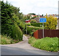
Woodfield Road is the name of this 800 metre long part of the B4060. The road joining from the left is The Quarry.
Image: © Jaggery Taken: 21 Jul 2012
0.08 miles
2
Woodfield allotments
Image: © Steve Fareham Taken: 27 Oct 2014
0.10 miles
3
Yew Tree Close, Cam
Viewed from The Quarry, about 80 metres north of Dursley Road.
Image: © Jaggery Taken: 21 Jul 2012
0.11 miles
4
Distinctive house in The Quarry, Cam
Viewed from the corner of Rock Road.
Image: © Jaggery Taken: 21 Jul 2012
0.11 miles
5
Unsuitable lane for wide vehicles, Cam
Viewed across Tait's Hill Road. What width is too wide for this lane is not shown.
Image: © Jaggery Taken: 21 Jul 2012
0.11 miles
6
SW boundary of Cam, a Fairtrade Village
A sign under the Cam boundary sign shows Welcome to our Fairtrade Village. The location is the junction of the B4066 Dursley Road on the right and the B4060 Woodfield Road on the left.
Image: © Jaggery Taken: 21 Jul 2012
0.11 miles
7
Mid-Victorian houses, The Quarry, Cam
Viewed from the corner of Rock Road. The inscription in stone on the wall is BARTON PLACE 1864.
Image: © Jaggery Taken: 21 Jul 2012
0.11 miles
8
The Yew Tree, Dursley
Viewed across Dursley Road. The pub is near the boundary signs for two villages, Stinchcombe and Cam. The street name sign on the side of the building shows The Quarry.
Image: © Jaggery Taken: 21 Jul 2012
0.13 miles
9
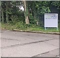
Vale Vats & Referrals nameboard, Stinchcombe
Facing Tait's Hill Road alongside the access road to the vets.
Image: © Jaggery Taken: 16 Jun 2024
0.13 miles
10
The Yew Tree public house, The Quarry, Gloucestershire
Image: © nick macneill Taken: 14 Oct 2012
0.13 miles
  • ...