
IMAGES TAKEN NEAR TO
Meadowvale, DURSLEY, GL11 6HH
Introduction
This page details the photographs taken nearby to Meadowvale, GL11 6HH by members of the Geograph project.
The Geograph project started in 2005 with the aim of publishing, organising and preserving representative images for every square kilometre of Great Britain, Ireland and the Isle of Man.

There are currently over 7.5m images from over14,400 individuals and you can help contribute to the project by visiting https://www.geograph.org.uk
Image Map
Images are licensed for reuse under creativecommons.org/licenses/by-sa/2.0
Notes
- Clicking on the map will re-center to the selected point.
- The higher the marker number, the further away the image location is from the centre of the postcode.
Image Listing (8 Images Found)
Images are licensed for reuse under creativecommons.org/licenses/by-sa/2.0
Image
Details
Distance
1
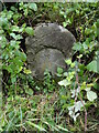
Old Milestone by B4066, Dursley Road
The Milestone is located between police station & The Quarry on embankment on the South of the road. Parish of Cam (Stroud District). Stone post (plate lost), erected by the Berkley & Dursley (Division) turnpike trust in the 19th Century, edge chips. An earlier photograph can be found here: https://www.geograph.org.uk/photo/6038638
Inscription reads:- (DURSLEY 1 / BERKELEY 4 / WOTTON 5) : : (CAM)
Grade II listed. List Entry Number: 1090110 https://historicengland.org.uk/listing/the-list/list-entry/1090110
Milestone Society National ID: GL_BKDY04
Image: © Roadside Relics
Taken: 21 Jul 2023
0.14 miles
2
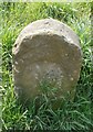
Old Milestone by the B4066, Dursley Road, Tilsdown, Cam
Stone post (plate lost) by the B4066, in parish of CAM (STROUD District), Dursley Road, between police station and The Quarry on embankment, on South side of road. Erected by the Berkley & Dursley (Division) turnpike trust in the 19th century.
Inscription once read:-
: (DURSLEY 1 / BERKELEY 4 / WOTTON 5) : : (CAM) :
Carved benchmark top right, rivet top centre.
Grade II listed. List Entry Number: 1090110
https://historicengland.org.uk/listing/the-list/list-entry/1090110
Milestone Society National ID: GL_BKDY04.
Image: © M Faherty
Taken: 10 Apr 2010
0.15 miles
3
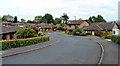
Lambsdowne, Cam
Viewed from the Dursley Road end. Lambsdowne is a cul-de-sac containing about 70 houses.
Image: © Jaggery
Taken: 21 Jul 2012
0.16 miles
4
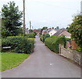
New Road, Cam
Viewed from Dursley Road looking towards Woodfield Road.
Image: © Jaggery
Taken: 21 Jul 2012
0.17 miles
5
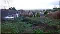
View over Tilsdown
Housing off Dursley Road, Cam
Image: © Jonathan Billinger
Taken: 7 Dec 2012
0.19 miles
6
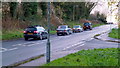
Rare motor on Dursley Road
The Bristol 411(?) is not far from the factory of origin here on the B4066 at Cam.
Image: © Jonathan Billinger
Taken: 7 Dec 2012
0.19 miles
8
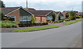
Broadmere bungalows, Cam
Viewed from Dursley Road.
Image: © Jaggery
Taken: 21 Jul 2012
0.20 miles