Old Milestone by B4066, Dursley Road
Introduction
The photograph on this page of Old Milestone by B4066, Dursley Road by Roadside Relics as part of the Geograph project.
The Geograph project started in 2005 with the aim of publishing, organising and preserving representative images for every square kilometre of Great Britain, Ireland and the Isle of Man.

There are currently over 7.5m images from over 14,400 individuals and you can help contribute to the project by visiting https://www.geograph.org.uk
Old Milestone by B4066, Dursley Road
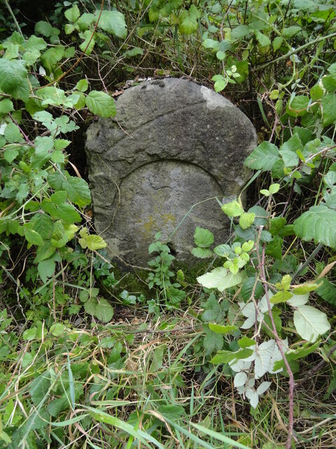
Image: © Roadside Relics Taken: 21 Jul 2023
The Milestone is located between police station & The Quarry on embankment on the South of the road. Parish of Cam (Stroud District). Stone post (plate lost), erected by the Berkley & Dursley (Division) turnpike trust in the 19th Century, edge chips. An earlier photograph can be found here: https://www.geograph.org.uk/photo/6038638 Inscription reads:- (DURSLEY 1 / BERKELEY 4 / WOTTON 5) : : (CAM) Grade II listed. List Entry Number: 1090110 https://historicengland.org.uk/listing/the-list/list-entry/1090110 Milestone Society National ID: GL_BKDY04
Images are licensed for reuse under creativecommons.org/licenses/by-sa/2.0
Image Location
Latitude
51.692856
Longitude
-2.370605