
IMAGES TAKEN NEAR TO
Pitt Court, DURSLEY, GL11 6EH
Introduction
This page details the photographs taken nearby to Pitt Court, GL11 6EH by members of the Geograph project.
The Geograph project started in 2005 with the aim of publishing, organising and preserving representative images for every square kilometre of Great Britain, Ireland and the Isle of Man.

There are currently over 7.5m images from over14,400 individuals and you can help contribute to the project by visiting https://www.geograph.org.uk
Image Map
Images are licensed for reuse under creativecommons.org/licenses/by-sa/2.0
Notes
- Clicking on the map will re-center to the selected point.
- The higher the marker number, the further away the image location is from the centre of the postcode.
Image Listing (9 Images Found)
Images are licensed for reuse under creativecommons.org/licenses/by-sa/2.0
Image
Details
Distance
1
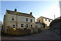
Houses at Pitt Court (2)
Cotswold House (seen at the rear of Image) and The Old Brewery are at right-angles to the lane eastward along Waterley Bottom.
Image: © Derek Harper
Taken: 2 Jan 2010
0.01 miles
2
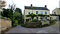
Large house at Pitt Court
See a winter shot with no Wisteria foliage - Image
Image: © Jonathan Billinger
Taken: 19 Oct 2012
0.01 miles
3
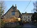
Houses at Pitt Court
The lane from Pitt Court along Waterley Bottom passes these houses immediately east of the lane junction seen in Image
Image: © Derek Harper
Taken: 2 Jan 2010
0.03 miles
4
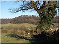
Approaching Pitt Court (2)
A little further down footpath CNN/33/1 than Image, with the oak tree close by, and the gate and signpost at the lane junction visible ahead. Ahead, on the upper south-facing slopes of Waterley Bottom.
Image: © Derek Harper
Taken: 2 Jan 2010
0.07 miles
5
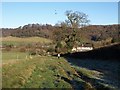
Approaching Pitt Court
Footpath CNN/33/1 runs down the side of this field past the oak to meet the road junction on the south of Pitt Court. Across Waterley Bottom, Park Wood rises above houses at Crowell Brook. The hillside behind the tree and to the right is in Image
Image: © Derek Harper
Taken: 2 Jan 2010
0.09 miles
6
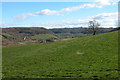
View of Waterley Bottom
Waterley Bottom viewed from footpath above Pitt Court.
Image: © Philip Halling
Taken: 27 Feb 2005
0.17 miles
7
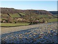
Frosty field above Waterley Bottom
A heavy frost remains as the sun hardly reaches this northeast-facing slope. Footpath CNN/33/1 crosses this field. The house on the left near Pitt Court, the slopes beyond it, and the further houses on the right (at Smart's Green) are all in Image; Sandfield Farm (behind the tree) is in Image
Image: © Derek Harper
Taken: 2 Jan 2010
0.18 miles
8
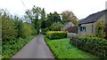
Smart's Green
Looking east towards Waterley.
Image: © Jonathan Billinger
Taken: 19 Oct 2012
0.21 miles
9
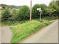
Grass triangle, Millend
As with Image], heavy traffic is asked to use the lane along the north side of Waterley Bottom rather than negotiate the tiny lane crossing the Doverte Brook. The houses on the left are at Pitt Court.
Image: © Derek Harper
Taken: 27 Oct 2014
0.23 miles