
IMAGES TAKEN NEAR TO
Uley, DURSLEY, GL11 5AH
Introduction
This page details the photographs taken nearby to GL11 5AH by members of the Geograph project.
The Geograph project started in 2005 with the aim of publishing, organising and preserving representative images for every square kilometre of Great Britain, Ireland and the Isle of Man.

There are currently over 7.5m images from over14,400 individuals and you can help contribute to the project by visiting https://www.geograph.org.uk
Image Map
Images are licensed for reuse under creativecommons.org/licenses/by-sa/2.0
Notes
- Clicking on the map will re-center to the selected point.
- The higher the marker number, the further away the image location is from the centre of the postcode.
Image Listing (27 Images Found)
Images are licensed for reuse under creativecommons.org/licenses/by-sa/2.0
Image
Details
Distance
1
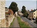
Uley, pathway
Raised footpath along narrow The Street.
Image: © Mike Faherty
Taken: 10 Apr 2010
0.04 miles
2
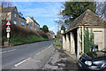
B4066, Uley
The main road through this Gloucestershire village. An interesting bus shelter is seen on the right.
Image: © Chris Allen
Taken: 10 Mar 2019
0.06 miles
3
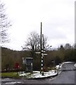
Communications on the edge of Uley
Crossroads with access to the valley to the south and a modern estate to the north, letter box and telephone box
Image: © David Smith
Taken: 29 Dec 2017
0.06 miles
4
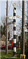
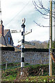
Old Direction Sign - Signpost by the B4066, The Street, Uley Parish
Annulus finial - 4 arms; Gloucestershire concrete by the B4066, in parish of Uley (Stroud District), The Street, junction with Fop Street, lower end of village.
Surveyed
Milestone Society National ID: GL_ST7897
Image: © Milestone Society
Taken: Unknown
0.07 miles
6
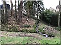
Site of Uley Wash Pool
A nearby stone records the fact that this is the location of the Uley village sheepwash.
Image: © don cload
Taken: 8 Jan 2018
0.07 miles
7
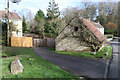
Lampern Hill, Uley
The stone bottom left marks the site of a former village sheep wash that was later adapted to wash cars and subsequently filled in.
Image: © Chris Allen
Taken: 10 Mar 2019
0.08 miles
9
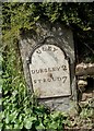
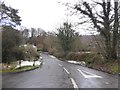
Old Milestone by the B4006, The Street, Uley
Metal plate attached to stone post by the B4066, in parish of ULEY (STROUD District), The Street, Uley, at West end of low wall on bend by Montpellier House, on North West side of road. Dursley plate, erected by the Berkley & Dursley (Division) turnpike trust in the 19th century.
Inscription reads:-
ULEY
DURSLEY 2
STROUD 7
Grade II listed.
List Entry Number: 1305553 https://historicengland.org.uk/listing/the-list/list-entry/1305553
Milestone Society National ID: GL_DYST02.
Image: © M Faherty
Taken: 10 Apr 2010
0.08 miles
10
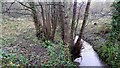
The diminutive River Ewelme
A Cotswolds stream south of Uley which feeds into the Cam and thence helps support the Gloucester Canal.
Image: © Jonathan Billinger
Taken: 12 Dec 2019
0.11 miles