Old Milestone by the B4006, The Street, Uley
Introduction
The photograph on this page of Old Milestone by the B4006, The Street, Uley by M Faherty as part of the Geograph project.
The Geograph project started in 2005 with the aim of publishing, organising and preserving representative images for every square kilometre of Great Britain, Ireland and the Isle of Man.

There are currently over 7.5m images from over 14,400 individuals and you can help contribute to the project by visiting https://www.geograph.org.uk
Old Milestone by the B4006, The Street, Uley
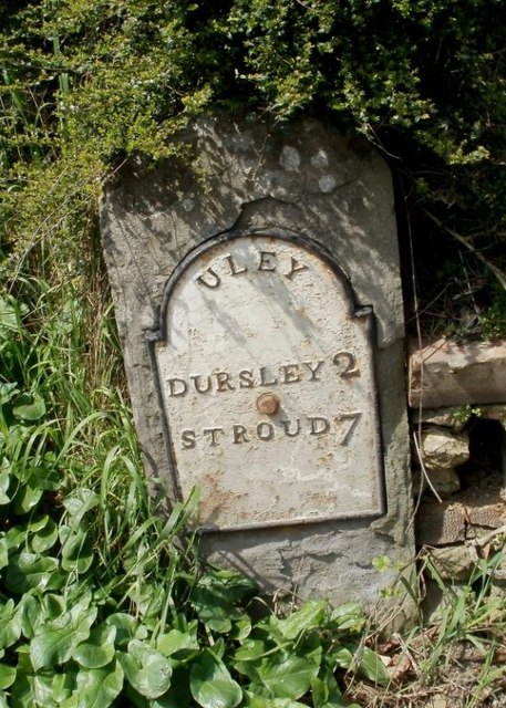
Image: © M Faherty Taken: 10 Apr 2010
Metal plate attached to stone post by the B4066, in parish of ULEY (STROUD District), The Street, Uley, at West end of low wall on bend by Montpellier House, on North West side of road. Dursley plate, erected by the Berkley & Dursley (Division) turnpike trust in the 19th century. Inscription reads:- ULEY DURSLEY 2 STROUD 7 Grade II listed. List Entry Number: 1305553 https://historicengland.org.uk/listing/the-list/list-entry/1305553 Milestone Society National ID: GL_DYST02.
Images are licensed for reuse under creativecommons.org/licenses/by-sa/2.0
Image Location
Latitude
51.681145
Longitude
-2.310124