1
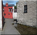
Henlow Drive, Dursley
Viewed from the A4135, here named Bull Pitch.
Image: © Jaggery
Taken: 21 Jul 2012
0.05 miles
2
The Slade, Dursley
Image: © Ian S
Taken: 20 Apr 2013
0.05 miles
3
The Slade, Dursley
Image: © Ian S
Taken: 20 Apr 2013
0.09 miles
4
Henlow House, Dursley
On the corner of Henlow Drive and Bull Pitch. The house was built c1870, enlarged in 1900.
Image: © Jaggery
Taken: 21 Jul 2012
0.11 miles
5
Grade II listed 6 The Broadwell, Dursley
Located in the oldest part of Dursley, this building dates from the early 16th century, though much altered since then. It was the Broadwell Tavern Inn for much of the 17th and 18th centuries. An unusual feature is that a nearby culverted stream opens up into a pond http://www.geograph.org.uk/photo/3053964 in front of the house.
Grade II listed in June 1961.
Image: © Jaggery
Taken: 21 Jul 2012
0.11 miles
6
Culverted stream emerges into a small pond, Broadwell, Dursley
Viewed from alongside Grade II listed number 6 The Broadwell. http://www.geograph.org.uk/photo/3053912
In the background is the tower of St James's Church.
Image: © Jaggery
Taken: 21 Jul 2012
0.11 miles
7
Pond alongside number 6 Broadwell, Dursley
The pond is fed from a stream emerging from a culvert behind the camera. http://www.geograph.org.uk/photo/3053944
Image: © Jaggery
Taken: 21 Jul 2012
0.11 miles
8
Broadwell plaque, Dursley
The plaque is on a wall near this pond http://www.geograph.org.uk/photo/3053964 which is fed by the spring.
Image: © Jaggery
Taken: 21 Jul 2012
0.11 miles
9
A 2000 replica of an 1827 Caution notice, Water Street, Dursley
The notice is on the wall of a Water Street house adjacent to a water channel, http://www.geograph.org.uk/photo/3054221 which is "the Stream running therefrom" in the notice.
Image: © Jaggery
Taken: 21 Jul 2012
0.11 miles
10
Water channel, Water Street, Dursley
Looking clear and clean today, things were likely to have been different in 1827,
or a little earlier, before the original of this http://www.geograph.org.uk/photo/3054190 replica notice was erected.
Image: © Jaggery
Taken: 21 Jul 2012
0.11 miles


