Grade II listed 6 The Broadwell, Dursley
Introduction
The photograph on this page of Grade II listed 6 The Broadwell, Dursley by Jaggery as part of the Geograph project.
The Geograph project started in 2005 with the aim of publishing, organising and preserving representative images for every square kilometre of Great Britain, Ireland and the Isle of Man.

There are currently over 7.5m images from over 14,400 individuals and you can help contribute to the project by visiting https://www.geograph.org.uk
Grade II listed 6 The Broadwell, Dursley
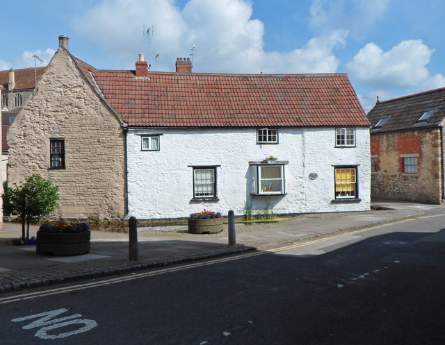
Image: © Jaggery Taken: 21 Jul 2012
Located in the oldest part of Dursley, this building dates from the early 16th century, though much altered since then. It was the Broadwell Tavern Inn for much of the 17th and 18th centuries. An unusual feature is that a nearby culverted stream opens up into a pond http://www.geograph.org.uk/photo/3053964 in front of the house. Grade II listed in June 1961.
Images are licensed for reuse under creativecommons.org/licenses/by-sa/2.0
Image Location
Latitude
51.680233
Longitude
-2.352857