
IMAGES TAKEN NEAR TO
Broadwell Terrace, DURSLEY, GL11 4JF
Introduction
This page details the photographs taken nearby to Broadwell Terrace, GL11 4JF by members of the Geograph project.
The Geograph project started in 2005 with the aim of publishing, organising and preserving representative images for every square kilometre of Great Britain, Ireland and the Isle of Man.

There are currently over 7.5m images from over14,400 individuals and you can help contribute to the project by visiting https://www.geograph.org.uk
Image Map
Images are licensed for reuse under creativecommons.org/licenses/by-sa/2.0
Notes
- Clicking on the map will re-center to the selected point.
- The higher the marker number, the further away the image location is from the centre of the postcode.
Image Listing (197 Images Found)
Images are licensed for reuse under creativecommons.org/licenses/by-sa/2.0
Image
Details
Distance
1
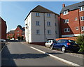
Victoria Close flats, Dursley
Built c2008, the flats are located between Long Street behind the camera, and Lister Street ahead.
Image: © Jaggery
Taken: 21 Jul 2012
0.02 miles
2
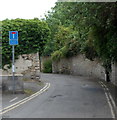
No turning beyond this point, Water Street, Dursley
The text in the title is on a No Through Road sign on Water Street.
Image: © Jaggery
Taken: 21 Jul 2012
0.02 miles
3
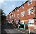
Newer Water Street housing, Dursley
This row of houses built c2008 contrasts with the part of Water Street near Bull Pitch, and the adjacent Broadwell, which contain some of the oldest houses in Dursley, such as this one. http://www.geograph.org.uk/photo/3053912
Image: © Jaggery
Taken: 21 Jul 2012
0.02 miles
4
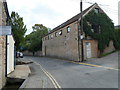
Number 1, Water Street, Dursley
Dating from c1800, 1 Water Street is about 25 metres long.
Image: © Jaggery
Taken: 21 Jul 2012
0.03 miles
5
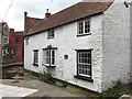
The Broadwell
The Broadwell - cottage in Water Street, Dursley.
Image: © Alan Hughes
Taken: 9 Jul 2016
0.03 miles
6
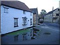
Dursley spring
At the time of Dursley's rise to prosperity, several woollen mills were grouped around this stream and spring.
Image: © Roger Cornfoot
Taken: 25 Jan 2007
0.03 miles
7
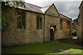
National School, Dursley
This former National School dates from 1833 and overlooks St James's churchyard.
Image: © Philip Halling
Taken: 22 Jun 2008
0.04 miles
8
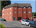
Flats on the corner of Lister Street and Phelps Mill Close, Dursley
Viewed across Lister Street.
Image: © Jaggery
Taken: 21 Jul 2012
0.04 miles
9
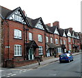
Bull Pitch houses, Dursley
Viewed from the eastern edge of Silver Street (the A4135) which continues as Bull Pitch ahead.
Image: © Jaggery
Taken: 21 Jul 2012
0.04 miles
10
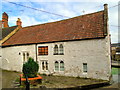
The former Broadwell Tavern
Dating from the 15th century and with a stream running by, now converted to housing.
Image: © Philip Pankhurst
Taken: 18 Feb 2014
0.05 miles