
IMAGES TAKEN NEAR TO
Oak Drive, DURSLEY, GL11 4DX
Introduction
This page details the photographs taken nearby to Oak Drive, GL11 4DX by members of the Geograph project.
The Geograph project started in 2005 with the aim of publishing, organising and preserving representative images for every square kilometre of Great Britain, Ireland and the Isle of Man.

There are currently over 7.5m images from over14,400 individuals and you can help contribute to the project by visiting https://www.geograph.org.uk
Image Map
Images are licensed for reuse under creativecommons.org/licenses/by-sa/2.0
Notes
- Clicking on the map will re-center to the selected point.
- The higher the marker number, the further away the image location is from the centre of the postcode.
Image Listing (31 Images Found)
Images are licensed for reuse under creativecommons.org/licenses/by-sa/2.0
Image
Details
Distance
1
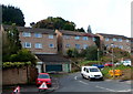
Everlands houses, Cam
These houses are at the southern end of a road named Everlands,
along a short spur adjacent to the Church Road/Kingshill Lane junction.
Image: © Jaggery
Taken: 7 Oct 2012
0.07 miles
2
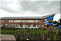
The New Vale Community Hospital
Lister Road (new)
Image: © richard ellis
Taken: 20 Jul 2012
0.10 miles
3
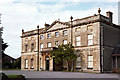
Kingshill House, Dursley
A noble late C18th front in marlstone and limestone, brutalised by alterations of 1876 which destroyed the symmetry. What were they thinking? Grade II* listed.
The house was used as council offices for a time, and after a period of dereliction, it is now run by a charity as an arts venue, with meetings rooms available for hire.
Image: © Stephen Richards
Taken: 19 Aug 2003
0.12 miles
4
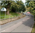
Southern boundary of Cam
Kingshill Lane, from Dursley, reaches the village of Cam, Gloucestershire.
Image: © Jaggery
Taken: 7 Oct 2012
0.13 miles
5
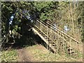
Disused footbridge
There is little evidence of the original railway line here but the footbridge remains open and is useable although there is a level path.
Image: © don cload
Taken: 21 Mar 2018
0.14 miles
6
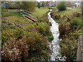
River Cam, Upper Cam
Viewed from Church Road. The River Cam was formerly a tributary of the River Severn into which it flowed at Frampton Pill, Frampton on Severn. Since the opening of the Gloucester and Sharpness Canal in 1827, the Cam has emptied into the canal.
Image: © Jaggery
Taken: 7 Oct 2012
0.15 miles
7
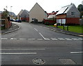
Ricardo Drive, Cam
Ricardo Drive is a recently built cul-de-sac of 20 houses, viewed across Church Road, Upper Cam.
Image: © Jaggery
Taken: 7 Oct 2012
0.16 miles
8
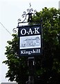
Oak at Kingshill (2) - sign, 2 Kingshill Road, Dursley, Glos
The sign shows a black and white drawing of the building. It is set on a post near the main road.
Image
Image
Image: © P L Chadwick
Taken: 12 Jul 2021
0.21 miles
9
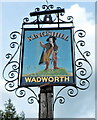
The Kingshill name sign, Dursley
The sign, and a flourish of metalwork, is on a post in a strip of grass alongside this http://www.geograph.org.uk/photo/3317975 pub.
Image: © Jaggery
Taken: 21 Jul 2012
0.21 miles
10
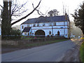
3C Community Church, Cam
The 3C Community Church on Church Road, Upper Cam.
Image: © David Dixon
Taken: 29 Feb 2012
0.21 miles