
IMAGES TAKEN NEAR TO
Woodmancote, DURSLEY, GL11 4AN
Introduction
This page details the photographs taken nearby to GL11 4AN by members of the Geograph project.
The Geograph project started in 2005 with the aim of publishing, organising and preserving representative images for every square kilometre of Great Britain, Ireland and the Isle of Man.

There are currently over 7.5m images from over14,400 individuals and you can help contribute to the project by visiting https://www.geograph.org.uk
Image Map
Images are licensed for reuse under creativecommons.org/licenses/by-sa/2.0
Notes
- Clicking on the map will re-center to the selected point.
- The higher the marker number, the further away the image location is from the centre of the postcode.
Image Listing (136 Images Found)
Images are licensed for reuse under creativecommons.org/licenses/by-sa/2.0
Image
Details
Distance
1
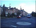
Georgian Dursley
An impressive group of Georgian 'town houses' line the road out of Dursley, towards Tetbury.
Image: © Roger Cornfoot
Taken: 25 Jan 2007
0.02 miles
2
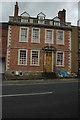
Georgian house in Dursley
A Georgian house in Woodmancote, Dursley.
Image: © Philip Halling
Taken: 5 Sep 2009
0.04 miles
3
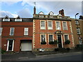
11 Woodmancote, Dursley
A distinguished house of the early to mid eighteenth century https://historicengland.org.uk/listing/the-list/list-entry/1220809
Image: © Jonathan Thacker
Taken: 26 Sep 2021
0.04 miles
4
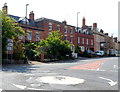
Woodmancote houses, Dursley
Woodmancote was once a separate hamlet, but since the start of the 20th century it has been absorbed by the encroachment of Dursley. In view are some of the twenty or so Grade II listed Georgian houses in Woodmancote.
Since a http://www.geograph.org.uk/photo/321496 view taken in winter 5½ years earlier, the brown sign on the left has been moved down to the bottom of the post.
Image: © Jaggery
Taken: 21 Jul 2012
0.05 miles
5
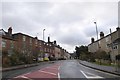
Woodmancote (A4135) in Dursley
The main road south lined with a variety of elegant houses, several of which date from the 18th century and are listed grade II
Image: © David Smith
Taken: 29 Dec 2017
0.05 miles
6
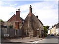
Cottage with external stone chimney, Dursley
At the end of Fort Lane; older maps suggest that there was another building between the junction and the cottage
Image: © David Smith
Taken: 15 Jun 2018
0.05 miles
7
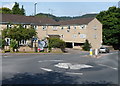
Dursley mini-roundabout
Located at the junction of Lister Street, Uley Road, Bull Pitch and Woodmancote.
Turn left for Tetbury, or right for the town centre, sports centre, Vale Community Hospital, Cam, Stinchcombe and Gloucester.
Image: © Jaggery
Taken: 21 Jul 2012
0.06 miles
8
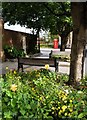
Castle Street, Dursley
A pleasant, beflowered corner beside Castle Street
Image: © Roger May
Taken: 25 Sep 2012
0.07 miles
9
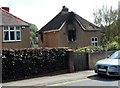
Fire-damaged house, Dursley
Though there was still a smell of burning in the air, I didn't know when I took this view that the fire had broken out here earlier the same day.
The local paper reported that no-one was injured by the fire, believed to have been caused by an electrical fault. The fire was detected by the occupier whose neighbour dialled 999. Gloucestershire Fire and Rescue was called to the fire at 1.33am. Two appliances were initially sent from Dursley Fire Station, but another crew was later sent from Wotton-under-Edge. It took 14 firefighters almost two hours to extinguish the blaze and the crews remained at the scene for more than four hours, making sure the fire was completely out and trying to save some of the occupier's possessions.
Image: © Jaggery
Taken: 21 Jul 2012
0.09 miles
10
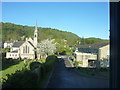
St Marks Church Vizard Close Woodmancote
Stinchcombe Hill is behind the Church and Dominates the area of Dursley
Image: © richard ellis
Taken: 1 May 2010
0.09 miles