1
Power and water together
Along Boakes Drive and at the end of the new housing is a small brick electricity substation. Right beside it is a pumping station with underground chambers.
Image: © Neil Owen
Taken: 7 Feb 2023
0.02 miles
2
A new face for Stroud
The milestone on the A419 is a treatment of the original eighteenth century stone. Previously, it used to stand on the old road a few metres east of its present position. Now the old railway line has been turned into the A road, it forms a junction with the old one and this is a more useful place for it. Note the plate is a very recent creation by the Stonehouse History Group in August, 2021, and sits on a fresh layer of concrete applied to the face. The old one was missing (as are so many originals).
Image: © Neil Owen
Taken: 7 Feb 2023
0.03 miles
3
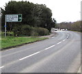
Directions sign alongside the A419 Bristol Road, Stonehouse
Turn right ahead into Downton Road for Leonard Stanley, Stanley Downton, Lower Mills, Bridgend.
Image: © Jaggery
Taken: 1 Apr 2018
0.03 miles
4
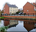
Houses aligned at right angles to the Stroudwater Canal, Stonehouse
Unlike neighbouring houses http://www.geograph.org.uk/photo/3248935 which face the canal, these Boakes Drive houses are orientated with their sides facing the canal.
Image: © Jaggery
Taken: 20 Nov 2011
0.04 miles
5
Cycle route 45, Stonehouse
This is part of the Bristol Road section of National Cycle Network route 45.
Image: © Jaggery
Taken: 24 Mar 2013
0.05 miles
6
Old Milestone, A419
Stonehouse Parish, re-sited and re-plated by the Stonehouse History Group http://stonehousehistorygroup.org.uk. The original position was the other side of the road
Image and due to roadwork was placed a little West of that see
Image
More recent roadworks necessitated a new location on the North side of the road. The original plate would have read "To / Stroud / 3 / Miles"
Inscription: Stroud / 3
Milestone Society National ID: GL_SDGL03
Image: © Mr Red
Taken: 22 Oct 2021
0.05 miles
7
Bristol Road houses and hedges, Stonehouse
The houses are alongside the former route of the A419 which now follows a straighter route on the camera side.
Image: © Jaggery
Taken: 1 Apr 2018
0.06 miles
8
Former route of Bristol Road, Stonehouse
A 1940s map shows that this road was part of the route of the A419 Bristol Road.
The straighter present-day section of the A419 is a few tens of metres behind the camera.
Image: © Jaggery
Taken: 24 Mar 2013
0.07 miles
9
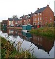
Canalside houses, Stonehouse
Boakes Drive houses viewed across the Stroudwater Canal.
Image: © Jaggery
Taken: 20 Nov 2011
0.07 miles
10
Old Milestone, A419, Stonehouse
Image after setting upright. Currently moved again to private location during 2019 road widening, & pending re-plating and re-setting by the Stonehouse History Group http://stonehousehistorygroup.org.uk . OSGR from old maps, because location was also subject to road widening after the 1965 closure of the Midland Line. More milestones in the area see http://umap.openstreetmap.fr/en/map/stonehouse-milestones_519080#14/51.7521/-2.2960
Stroud 3
Milestone Society National ID: GL_SDGL03
Image: © Mr Red
Taken: 20 Jan 2019
0.07 miles


