Old Milestone, A419
Introduction
The photograph on this page of Old Milestone, A419 by Mr Red as part of the Geograph project.
The Geograph project started in 2005 with the aim of publishing, organising and preserving representative images for every square kilometre of Great Britain, Ireland and the Isle of Man.

There are currently over 7.5m images from over 14,400 individuals and you can help contribute to the project by visiting https://www.geograph.org.uk
Old Milestone, A419
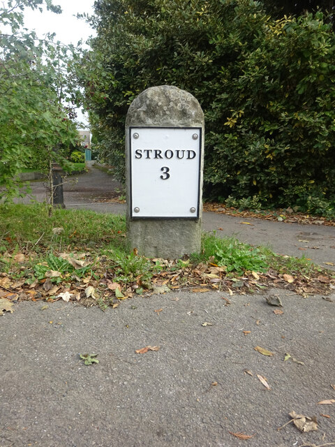
Image: © Mr Red Taken: 22 Oct 2021
Stonehouse Parish, re-sited and re-plated by the Stonehouse History Group http://stonehousehistorygroup.org.uk. The original position was the other side of the road Image and due to roadwork was placed a little West of that see Image More recent roadworks necessitated a new location on the North side of the road. The original plate would have read "To / Stroud / 3 / Miles" Inscription: Stroud / 3 Milestone Society National ID: GL_SDGL03
Images are licensed for reuse under creativecommons.org/licenses/by-sa/2.0
Image Location
Latitude
51.742948
Longitude
-2.286288