IMAGES TAKEN NEAR TO
Shandon, HELENSBURGH, G84 8NR
Introduction
This page details the photographs taken nearby to G84 8NR by members of the Geograph project.
The Geograph project started in 2005 with the aim of publishing, organising and preserving representative images for every square kilometre of Great Britain, Ireland and the Isle of Man.

There are currently over 7.5m images from over14,400 individuals and you can help contribute to the project by visiting https://www.geograph.org.uk
Image Map
Images are licensed for reuse under creativecommons.org/licenses/by-sa/2.0
Notes
- Clicking on the map will re-center to the selected point.
- The higher the marker number, the further away the image location is from the centre of the postcode.
Image Listing (16 Images Found)
Images are licensed for reuse under creativecommons.org/licenses/by-sa/2.0
Image
Details
Distance
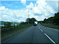
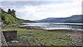
2
Coastal Road at Shandon
The A814, coastal Road, alongside Gare Loch.
Image: © David Dixon
Taken: 19 Apr 2012
0.08 miles
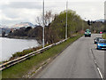
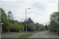
5
Eastern shoreline of Gare Loch near Shandon
Image: © Anthony O'Neil
Taken: 5 Jun 2010
0.18 miles
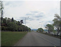
6
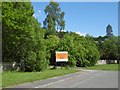
Development site, Shandon
Sign on the A814.
Image: © Richard Webb
Taken: 31 May 2016
0.20 miles
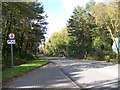
7
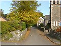
Kirk Brae, Shandon
Image: © Lairich Rig
Taken: 15 Oct 2012
0.21 miles
9
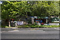
Faslane Peace Camp
It has been occupied continuously, since June 1982.The site and look of the camp has varied considerably over the years, depending on the number of residents. At one point there were two sites. The camp is well established with planning permission for 12 caravans and it has mains water, conventional toilet, a telephone, hot water. The tenancy was ended when the council borders changed. The council then organised an eviction order but decided not to waste money on a large-scale eviction so they now remain there, technically as squatters.
Image: © George Rankin
Taken: 25 May 2007
0.22 miles
10
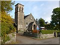
Old Shandon Free Church
For a closer look, see William Craig's earlier photograph: Image As suggested there, it is no longer a church; it was converted into four individual dwellings in 1986, losing a steeple in the process [see "North Clyde Estuary: An Illustrated Architectural Guide" (1991) by Frank A Walker and Fiona J Sinclair].
The church (Free Church of Scotland), at the foot of Image, was built in 1844, with additions in 1883. Near the right-hand edge of the photo, an original entrance can be seen, though it is now blocked.
Shandon War Memorial used to be located in front of the church, but it has been relocated: Image
Image: © Lairich Rig
Taken: 15 Oct 2012
0.22 miles