Old Shandon Free Church
Introduction
The photograph on this page of Old Shandon Free Church by Lairich Rig as part of the Geograph project.
The Geograph project started in 2005 with the aim of publishing, organising and preserving representative images for every square kilometre of Great Britain, Ireland and the Isle of Man.

There are currently over 7.5m images from over 14,400 individuals and you can help contribute to the project by visiting https://www.geograph.org.uk
Old Shandon Free Church
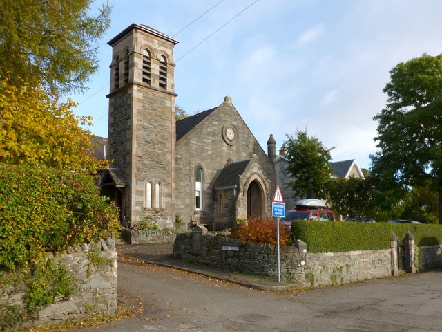
Image: © Lairich Rig Taken: 15 Oct 2012
For a closer look, see William Craig's earlier photograph: Image As suggested there, it is no longer a church; it was converted into four individual dwellings in 1986, losing a steeple in the process [see "North Clyde Estuary: An Illustrated Architectural Guide" (1991) by Frank A Walker and Fiona J Sinclair]. The church (Free Church of Scotland), at the foot of Image, was built in 1844, with additions in 1883. Near the right-hand edge of the photo, an original entrance can be seen, though it is now blocked. Shandon War Memorial used to be located in front of the church, but it has been relocated: Image
Images are licensed for reuse under creativecommons.org/licenses/by-sa/2.0
Image Location
Latitude
56.039834
Longitude
-4.803359