IMAGES TAKEN NEAR TO
Rosneath Drive, HELENSBURGH, G84 8DP
Introduction
This page details the photographs taken nearby to Rosneath Drive, G84 8DP by members of the Geograph project.
The Geograph project started in 2005 with the aim of publishing, organising and preserving representative images for every square kilometre of Great Britain, Ireland and the Isle of Man.

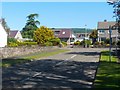
There are currently over 7.5m images from over14,400 individuals and you can help contribute to the project by visiting https://www.geograph.org.uk
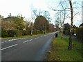
Image Map
Images are licensed for reuse under creativecommons.org/licenses/by-sa/2.0
Notes
- Clicking on the map will re-center to the selected point.
- The higher the marker number, the further away the image location is from the centre of the postcode.
Image Listing (40 Images Found)
Images are licensed for reuse under creativecommons.org/licenses/by-sa/2.0
Image
Details
Distance
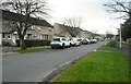
2
West King Street
Seen from the junction with Woodend Street.
Image: © Richard Sutcliffe
Taken: 27 Jan 2022
0.07 miles
3
Restricted access
I don't know what access is restricted on this part of West Princes Street - it's not at all obvious.
Image: © Richard Sutcliffe
Taken: 27 Jan 2022
0.10 miles
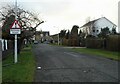
5
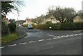
Bannachra Drive
At the junction with Woodend Street. The sign in the hedge says 'Warning Children', but is half hidden and so not really doing its job.
Image: © Richard Sutcliffe
Taken: 27 Jan 2022
0.12 miles
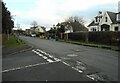
6
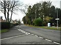
Rhu Road Higher
The woodland on the right is the southern end of Duchess Wood. Woodend Street is to the left.
Image: © Richard Sutcliffe
Taken: 27 Jan 2022
0.12 miles
7
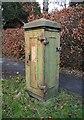
Old electricity junction box
Beside West King Street. It does not appear to be in use. The only identification feature on it is a cast circular motif with a 'B' in the centre near the top of one side.
Image: © Richard Sutcliffe
Taken: 27 Jan 2022
0.13 miles
8
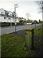
Old electricity junction box and bus stop
On West King Street. See Image for a closer view.
Image: © Richard Sutcliffe
Taken: 27 Jan 2022
0.13 miles
9
Camsail Avenue, Helensburgh
The photograph was taken from the junction with West Clyde Street / Rhu Road Lower (the street name changes at about that point). The short Camsail Avenue leads away from the photographer's position, and towards Ferniegair Avenue, which appears in the background.
Image: © Lairich Rig
Taken: 3 Jun 2011
0.14 miles
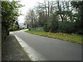
10
West Montrose Street
The road is called Rhu Road Higher to the west of here.
Image: © Richard Sutcliffe
Taken: 27 Jan 2022
0.15 miles