1
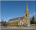
St Joseph's R.C. Church
The church (1911) was designed by the Belgian-born C J Menart. It is located on the corner of Lomond Street and East King Street. Another contributor's earlier photograph shows it from a different angle:
Image
See
Image for a closer view of the details above the entrance.
Image: © Lairich Rig
Taken: 27 Mar 2013
0.02 miles
2
St Joseph's R.C. Church: detail
"Sancte Joseph, ora pro nobis". See
Image for the whole building in context, and for further details.
Image: © Lairich Rig
Taken: 27 Mar 2013
0.03 miles
3
Police Station, Helensburgh
The steeple behind is the Park Church, a separate building.
Image: © Tom Sargent
Taken: 5 Oct 2008
0.04 miles
4
Overhead electric gantry on railway near Helensburgh Central
Image: © Anthony O'Neil
Taken: 5 Jun 2010
0.04 miles
5
Footbridge across the railway near Helensburgh Central
Image: © Anthony O'Neil
Taken: 5 Jun 2010
0.05 miles
6
Meditation Centre of Scotland
Former Park Church, built in 1862, which is Category B listed http://portal.historicenvironment.scot/designation/LB34714.
Image: © Richard Sutcliffe
Taken: 24 Dec 2019
0.05 miles
7
Park Church
The building, which stands on the corner of Charlotte Street and East King Street, is by John Honeyman; the foundation stone was laid in 1862, and the church opened in 1863. The interior was remodelled (1887-88) by William Leiper, the changes including a new staircase.
At one stage of its history, it was known as Park United Free Church. In Helensburgh Cemetery – http://www.geograph.org.uk/snippet/8777 – there is a memorial to its minister Henry Norwell M.A. (1861-1904), who was born at Perth; the memorial was, according to its inscription, "erected by the congregation of Park United Free Church".
Image: © Lairich Rig
Taken: 2 Apr 2013
0.05 miles
8
St Joseph's Church (RC) Helensburgh
Image: © J M Briscoe
Taken: 7 May 2005
0.05 miles
9
Lomond Street, Helensburgh
Not far ahead is one end of a footbridge over the railway line; Lomond Street continues on the far side of that bridge. The large building near the centre of the picture was employed as a drill hall during the First World War, and is currently a TA centre.
There was no building on that site when the first-edition OS map was surveyed in 1860. A long narrow building, captioned "drill hall", is marked on the second-edition map (revised c.1897). On the 1914 revision of the map, the building is much larger: it had been expanded to the south-west, and was almost square; this corresponds to its present-day appearance.
Another contributor's article lists the various buildings that were used as drill halls during the First World War: http://www.geograph.org.uk/article/WW1-Great-War-Centenary---Drill-Halls
Image: © Lairich Rig
Taken: 9 Jun 2014
0.06 miles
10
East King Street
Looking east outside the police station.
Image: © Thomas Nugent
Taken: 10 Aug 2013
0.06 miles


