Lomond Street, Helensburgh
Introduction
The photograph on this page of Lomond Street, Helensburgh by Lairich Rig as part of the Geograph project.
The Geograph project started in 2005 with the aim of publishing, organising and preserving representative images for every square kilometre of Great Britain, Ireland and the Isle of Man.

There are currently over 7.5m images from over 14,400 individuals and you can help contribute to the project by visiting https://www.geograph.org.uk
Lomond Street, Helensburgh
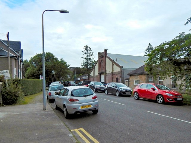
Image: © Lairich Rig Taken: 9 Jun 2014
Not far ahead is one end of a footbridge over the railway line; Lomond Street continues on the far side of that bridge. The large building near the centre of the picture was employed as a drill hall during the First World War, and is currently a TA centre. There was no building on that site when the first-edition OS map was surveyed in 1860. A long narrow building, captioned "drill hall", is marked on the second-edition map (revised c.1897). On the 1914 revision of the map, the building is much larger: it had been expanded to the south-west, and was almost square; this corresponds to its present-day appearance. Another contributor's article lists the various buildings that were used as drill halls during the First World War: http://www.geograph.org.uk/article/WW1-Great-War-Centenary---Drill-Halls
Images are licensed for reuse under creativecommons.org/licenses/by-sa/2.0
Image Location
Latitude
56.003178
Longitude
-4.726429