IMAGES TAKEN NEAR TO
Main Road, HELENSBURGH, G84 0RQ

Introduction

This page details the photographs taken nearby to Main Road, G84 0RQ by members of the Geograph project.

The Geograph project started in 2005 with the aim of publishing, organising and preserving representative images for every square kilometre of Great Britain, Ireland and the Isle of Man.

There are currently over 7.5m images from over14,400 individuals and you can help contribute to the project by visiting https://www.geograph.org.uk

Image Map


Images are licensed for reuse under creativecommons.org/licenses/by-sa/2.0
Notes
  • Clicking on the map will re-center to the selected point.
  • The higher the marker number, the further away the image location is from the centre of the postcode.

Image Listing (16 Images Found)

Images are licensed for reuse under creativecommons.org/licenses/by-sa/2.0
Image
Details
Distance
1
St. Gildas R.C. church
A view looking west across the B833 towards St. Gildas Roman Catholic Church.
Image: © Phil Williams Taken: 28 May 2006
0.10 miles
2
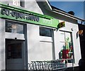
Co-operative store and Post Office, Rosneath
Image: © Stephen Sweeney Taken: 28 Sep 2014
0.11 miles
3
Fitba' in the park
A view looking to the northwest across the playing fields of Howie Park, with a football match in progress. The white building at right is the Princess Louise Memorial Hall, named after a relative of Queen Victoria and an erstwhile resident of Rosneath Castle.
Image: © Phil Williams Taken: 28 May 2006
0.14 miles
4
Co-op Post Office
Image: © Lynn M Reid Taken: 9 Apr 2008
0.14 miles
5
Church at Roseneath
Image: © william craig Taken: 13 Oct 2005
0.15 miles
6
The church at Rosneath
At the heart of the seaside community.
Image: © James Denham Taken: 18 Sep 2014
0.15 miles
7
New House, Rosneath
Image: © Alex McGregor Taken: 25 Nov 2013
0.15 miles
8
Rosneath Primary School
A view looking west towards the primary school at Rosneath. This building also housed the Library when I lived in the village during the early 1980s. I am not sure that this is still the case.
Image: © Phil Williams Taken: 28 May 2006
0.16 miles
9
St. Modans, Rosneath
A view looking west from Tom-a-Mhoid towards the church of St. Modan. A plaque at the entrance to the churchyard states " There has been a Christian church in Rosneath since the time of St. Modan in the 7th century. Near the present Church are the ruins of an earlier sanctuary surrounded by an Historic Churchyard."
Image: © Phil Williams Taken: 28 May 2006
0.17 miles
10
Sanctuary ruins
A view looking southeast over the old churchyard to the ruins of the sanctuary building at Rosneath.
Image: © Phil Williams Taken: 28 May 2006
0.17 miles