IMAGES TAKEN NEAR TO
Kingfisher Avenue, ALEXANDRIA, G83 9PY
Introduction
This page details the photographs taken nearby to Kingfisher Avenue, G83 9PY by members of the Geograph project.
The Geograph project started in 2005 with the aim of publishing, organising and preserving representative images for every square kilometre of Great Britain, Ireland and the Isle of Man.

There are currently over 7.5m images from over14,400 individuals and you can help contribute to the project by visiting https://www.geograph.org.uk
Image Map
Images are licensed for reuse under creativecommons.org/licenses/by-sa/2.0
Notes
- Clicking on the map will re-center to the selected point.
- The higher the marker number, the further away the image location is from the centre of the postcode.
Image Listing (52 Images Found)
Images are licensed for reuse under creativecommons.org/licenses/by-sa/2.0
Image
Details
Distance
1
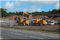
Construction at Mill Fields: upper level
Image: © Lairich Rig
Taken: 21 Jun 2018
0.02 miles
2
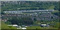
The Mill Fields development
The title refers to the light-coloured houses above the centre of the picture. By the time this picture was submitted, street names for the recently-built houses appeared on large-scale mapping: the houses are on Kingfisher Avenue and Osprey Place.
This is a distant view; it is otherwise difficult to show the housing development in its entirety. Click on the end-note title for closer views of the site, some of them showing its construction.
The nearer, darker houses are in Strathleven Estate. Closer still are some of the buildings in the Vale of Leven Industrial Estate. The houses in the background of the photograph are in the Beechwood and Wheatcroft Estates.
The viewpoint for the picture was a Image
Image: © Lairich Rig
Taken: 29 May 2020
0.02 miles
4
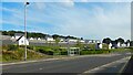
Construction at Mill Fields
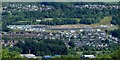
The construction site runs across the centre of the image from left to right. As shown here, work was still taking place on the upper level of housing. An equivalent later view shows the completed development: Image
Click on the end-note title for other views.
The nearer houses are in Strathleven Estate, and the further ones are in the Beechwood and Wheatcroft Estates, with the ground of the Vale of Leven Rugby Club located between them and the construction site. A small part of the Vale of Leven Industrial Estate can be seen in the foreground.
The picture was taken from a Image, a good place from which to get a clear view of the whole construction site, if only from a distance.
Image: © Lairich Rig
Taken: 24 Jun 2018
0.03 miles
5
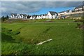
Mill Fields: northern end
Work was still taking place on the upper level; compare Image
Image: © Lairich Rig
Taken: 4 Sep 2018
0.05 miles
6
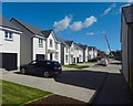
Mill Fields: the upper level
Image leads to this point, at the northern end of the upper level of housing. The houses ahead (south) are still under construction: Image
Image: © Lairich Rig
Taken: 21 Jun 2018
0.05 miles
7
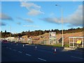
Construction of Mill Fields
At this stage of the construction project, temporary traffic lights had been installed on Stirling Road, and some lanes had been closed.
Image: © Lairich Rig
Taken: 6 Nov 2016
0.05 miles
8
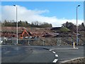
Construction of Mill Fields
The view is from beside a new roundabout (Image). The sloping ground (shown before construction in Image) has been laid out in terraces.
Image: © Lairich Rig
Taken: 20 Feb 2017
0.07 miles
9
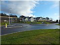
The Mill Fields development
This is the southern part of the site; the nearest building is the show home. For the northern part, see Image
Click on the end-note title for related pictures.
Image: © Lairich Rig
Taken: 11 Feb 2018
0.07 miles