
IMAGES TAKEN NEAR TO
Ferryfield Gardens, ALEXANDRIA, G83 0TB
Introduction
This page details the photographs taken nearby to Ferryfield Gardens, G83 0TB by members of the Geograph project.
The Geograph project started in 2005 with the aim of publishing, organising and preserving representative images for every square kilometre of Great Britain, Ireland and the Isle of Man.

There are currently over 7.5m images from over14,400 individuals and you can help contribute to the project by visiting https://www.geograph.org.uk
Image Map
Images are licensed for reuse under creativecommons.org/licenses/by-sa/2.0
Notes
- Clicking on the map will re-center to the selected point.
- The higher the marker number, the further away the image location is from the centre of the postcode.
Image Listing (151 Images Found)
Images are licensed for reuse under creativecommons.org/licenses/by-sa/2.0
Image
Details
Distance
1
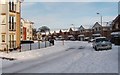
Ferryfield Gardens, Alexandria
The picture was taken from the junction with Image; the building at the extreme right in that photograph appears on the left in this one. The Ferryfields development was built c.2005.
The name comes from the Ferryfield Print Works which once occupied this area.
Image: © Lairich Rig
Taken: 29 Nov 2010
0.01 miles
2
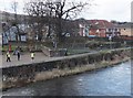
KiltWalk 2013 - only a mile and a half to go!
View from Bonhill Bridge, Alexandria: KiltWalkers making good time - this is about five and a half hours into the walk, with 24 and a half miles completed, so these walkers have kept up a rattling pace of well-over 4mph. The marshals told me there had been about ten people just ahead of this group. See also Image and Image
Image: © Barbara Carr
Taken: 21 Apr 2013
0.04 miles
3
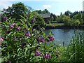
Common Comfrey
(Symphytum officinale)
See Image, which shows this patch in the foreground, for more context. In the present view, and likewise included to provide some identifiable context, is Image on the other bank of the Leven.
The plant itself has long "wings" (flange-like features) running down the stem from the point of attachment of the leaves. In this and other respects, it differs from Image (shown further downriver). Some other Comfrey species or hybrids are commonly encountered.
Image: © Lairich Rig
Taken: 24 May 2018
0.04 miles
4
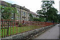
St. Mary's Primary School
View of St. Mary's Primary School, Bank Street Alexandria
Image: © George Rankin
Taken: 12 Aug 2002
0.04 miles
5
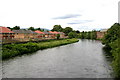
Ferry Loan Housing Alexandria
New Housing estate at Ferry Loan Alexandria
Image: © Eddie Mackinnon
Taken: 24 Jun 2006
0.04 miles
6
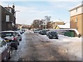
Bank Street, Alexandria
See Image for an earlier view. Although the photographs look quite different, the viewpoints are not far apart; the same building appears on the left in both pictures, and Image is visible in the distance.
In the present photograph, the large building on the right, in the middle distance, is Image
Image: © Lairich Rig
Taken: 29 Nov 2010
0.04 miles
7
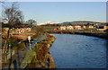
River Leven
Looking up the River Leven from Bonhill Bridge on a frosty morning. A snowy Ben Lomond is visible in the background.
Image: © Mark Nightingale
Taken: 3 Dec 2008
0.04 miles
8
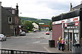
Bank Street Alexandria
Photograph taken from the Bonhill Bridge end of Bank Street Alexandria
Image: © Eddie Mackinnon
Taken: 24 Jun 2006
0.05 miles
9
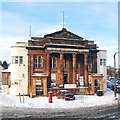
Former public hall, Alexandria
This category B listed building stands at the junction of Bridge Street and Bank Street (visible on the right), and was built in 1862 as a public hall. It was later put to use as the Hall Cinema, and then, as the remaining lettering shows, the Vale Bingo Club. At the time when this photograph was taken, it was being used as a furniture showroom. For another view, see Image
Its listed building report provides further details: http://portal.historic-scotland.gov.uk/designation/LB43193 (at Historic Environment Scotland).
An old photograph of Bonhill Bridge from c.1893 shows a small structure in front of this building: a drinking fountain, which was "a gift to the community by the Smolletts, and was erected in 1879 to commemorate the opening of the 'Tank' or Overton Reservoir (Image). The fountain was removed in the 1930s presumably because cars were more reluctant to go round it than horses had been" ["The Old Vale and the New", Jones/Hopner, 1981].
(The reservoir mentioned above is shown in Image)
Image: © Lairich Rig
Taken: 29 Nov 2010
0.06 miles
10
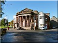
Former public hall, Alexandria
Amongst other things, this has been public hall, a cinema, and a bingo club. The date 1862 appears in the roundel at the top of the building. For further details, see Image
Image: © Lairich Rig
Taken: 5 Oct 2012
0.06 miles