
IMAGES TAKEN NEAR TO
Govan Drive, ALEXANDRIA, G83 0QE
Introduction
This page details the photographs taken nearby to Govan Drive, G83 0QE by members of the Geograph project.
The Geograph project started in 2005 with the aim of publishing, organising and preserving representative images for every square kilometre of Great Britain, Ireland and the Isle of Man.

There are currently over 7.5m images from over14,400 individuals and you can help contribute to the project by visiting https://www.geograph.org.uk
Image Map
Images are licensed for reuse under creativecommons.org/licenses/by-sa/2.0
Notes
- Clicking on the map will re-center to the selected point.
- The higher the marker number, the further away the image location is from the centre of the postcode.
Image Listing (62 Images Found)
Images are licensed for reuse under creativecommons.org/licenses/by-sa/2.0
Image
Details
Distance
1
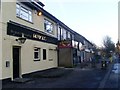
Public house in Alexandria
Just to the north of the factory outlets.
Image: © Stephen Sweeney
Taken: 6 Dec 2008
0.01 miles
2
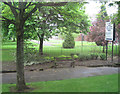
Vale Of Leven swimming pool gardens
On B857 Luss road
Image: © John Firth
Taken: 10 May 2011
0.02 miles
4
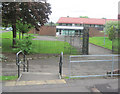
Vale Of Leven Swimming Pool
On corner of Luss Road and Heather Avenue
Image: © John Firth
Taken: 10 May 2011
0.07 miles
5
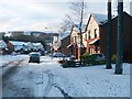
Glenmore Avenue, Ardenwood
The Ardenwood estate was built in 1995. The photograph was taken from the main road through Alexandria.
Image: © Lairich Rig
Taken: 29 Nov 2010
0.08 miles
6
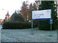
Sign at entrance to Vale of Leven Hospital
With the former Argyll Motor Works building, and now Loch Lomond Factory Outlets, in the background.
Image: © Stephen Sweeney
Taken: 6 Dec 2008
0.10 miles
8
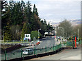
Luss Road
The B857, formerly the A82, viewed from the cafe in the former Argyll Motor Works building which is now a retail outlet shopping centre known as Lomond Gallery Shopping Centre.
Ben Lomond can be seen in the distance.
Image: © Thomas Nugent
Taken: 1 Apr 2013
0.11 miles
9
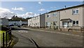
Bannachra Crescent, Tullichewan
This street is at the south-eastern extremity of the Tullichewan housing estate. Much of this grid square is taken up by Tullichewan and by Levenvale, the latter area of housing being on the other side of the main road (Luss Road); so, for representative views of the grid square, I have included several such street scenes.
See also Image, taken from further ahead, around the corner.
On the name Tullichewan itself, which long pre-dates this area of housing, see Image
Image: © Lairich Rig
Taken: 6 Feb 2013
0.12 miles
10
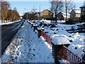
Heather Avenue
This road leaves the main road through Alexandria at the northern end of Image It leads towards Lomond Industrial Estate and Rosshead, but also provides access to the estate that is visible on the right. Argyll Park is to the left of the road.
Image: © Lairich Rig
Taken: 29 Nov 2010
0.13 miles