
IMAGES TAKEN NEAR TO
McColl Avenue, ALEXANDRIA, G83 0JB
Introduction
This page details the photographs taken nearby to McColl Avenue, G83 0JB by members of the Geograph project.
The Geograph project started in 2005 with the aim of publishing, organising and preserving representative images for every square kilometre of Great Britain, Ireland and the Isle of Man.

There are currently over 7.5m images from over14,400 individuals and you can help contribute to the project by visiting https://www.geograph.org.uk
Image Map
Images are licensed for reuse under creativecommons.org/licenses/by-sa/2.0
Notes
- Clicking on the map will re-center to the selected point.
- The higher the marker number, the further away the image location is from the centre of the postcode.
Image Listing (27 Images Found)
Images are licensed for reuse under creativecommons.org/licenses/by-sa/2.0
Image
Details
Distance
1
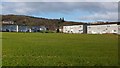
Open space in Tullichewan
The houses in the background are on Bannachra Crescent (left) and around Hudspeth Court (right).
Image: © Lairich Rig
Taken: 6 Feb 2013
0.07 miles
2
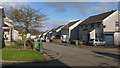
Woodbank Gardens, Tullichewan
This street is at the western edge of the Tullichewan area; further on, it meets Image
Image: © Lairich Rig
Taken: 6 Feb 2013
0.09 miles
3
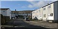
Bannachra Crescent, Tullichewan
See also Image; with respect to that view, the present photograph was taken from further along the road, around the corner. The chimney in the background, left of centre, is associated with Image
Image: © Lairich Rig
Taken: 6 Feb 2013
0.11 miles
4
Woodland, Tullichewan
Scrubby woodland beside the A82.
Image: © Richard Webb
Taken: 8 Mar 2008
0.11 miles
5
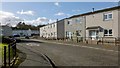
Bannachra Crescent, Tullichewan
This street is at the south-eastern extremity of the Tullichewan housing estate. Much of this grid square is taken up by Tullichewan and by Levenvale, the latter area of housing being on the other side of the main road (Luss Road); so, for representative views of the grid square, I have included several such street scenes.
See also Image, taken from further ahead, around the corner.
On the name Tullichewan itself, which long pre-dates this area of housing, see Image
Image: © Lairich Rig
Taken: 6 Feb 2013
0.13 miles
6
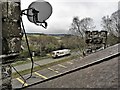
The A82 road at Tullichewan
The A82 from the roof of Tullichewan Stables Cottage.
Image: © Raibeart MacAoidh
Taken: 21 Mar 2019
0.14 miles
7
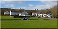
Woodlands Court, Tullichewan
Woodlands Court is at the north-western extremity of the Tullichewan area. The picture was taken from Image
Image: © Lairich Rig
Taken: 6 Feb 2013
0.15 miles
8
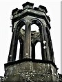
Tullichewan Stables Cottage Bell Tower
West side of the bell tower, taken from the roof of Tullichewn Stables Cottage.
The Tullichewan estate was bought from the Colquhouns of Luss by John Stirling of Cordale in 1792. The castle was designed by the architect Robert Lugar, who also designed Balloch Castle. It is the first example in Scotland of an asymmetrical Gothic house. The grounds of the castle were laid out by Alexander Naysmith, landscape gardener, architect and, most famously, artist, principally remembered for his portrait of Robert Burns.
John Horrocks junior of Horrocks and Company, cotton manufacturers, of Preston, purchased the castle in 1817 and lived there until the death of his wife in 1843. The estate was then sold to William Campbell of J & W Campbell, Glasgow merchants. The estate remained in the Campbell family until the twentieth century. The last owner of the castle was J. Scott Anderson, who lived there from about 1930. The castle was requisitioned during WWII for use by the WRNS and naval personnel. Latterly the castle was used as accommodation for workers at the Torpedo factory, which now houses the Loch Lomond Factory Outlets. After that it lay unused for many years before being demolished in 1954.
Image: © Raibeart MacAoidh
Taken: 21 Mar 2019
0.15 miles
9
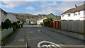
Tullichewan Drive
This is the main road leading into Tullichewan, an area of housing on the western side of Luss Road. Tullichewan Road more or less bisects the estate.
The name has been associated with this area for a long time, and there used to be a Tullichewan Castle nearby: see, for example, Image
In connection with that name, some nineteenth-century authors(*) used the form Tilly-Colquhoun. However, to my mind, that has the appearance of folk etymology; in any case, it is not borne out by early forms of the name. It is quite likely that it contains the Gaelic element "tulach" (knoll, hillock), but the overall meaning is uncertain. (Compare the name Tullochan, at Image, about 5.5 km NNE of here.)
By way of illustration, the following are authentic older spellings (although not necessarily the very oldest). The Lennox Cartulary has a charter by Earl Malcolm (before 1333), in which the spelling is "Tulochewyne", quite close to the present form.
The following later examples are from the Register of the Great Seal of Scotland (RMS), with the year of the relevant Latin charter given in parentheses: "et tribus Tullequhwnys" (1507); "terras de tribus Tulliquhewnys" (1512); "Tullichquhoneis" (1545); "Tullichewynnis" (also 1545).
The various RMS spellings appear to be plural in form, "Tullichewans". In fact, the Latin entries from 1507 and 1512, quoted above, both refer to "the lands of the three Tullichewans".
[(*) For example, Joseph Irving, in his "History of Dumbartonshire" (1860), writes that "in the north-west part of Bonhill parish are the lands of Tillichewan, or Tilly-Colquhoun".]
Image: © Lairich Rig
Taken: 6 Feb 2013
0.15 miles
10
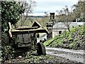
Tullichewan Stables Cottage
The Tullichewan estate was bought from the Colquhouns of Luss by John Stirling of Cordale in 1792. The castle was designed by the architect Robert Lugar, who also designed Balloch Castle. It is the first example in Scotland of an asymmetrical Gothic house. The grounds of the castle were laid out by Alexander Naysmith, landscape gardener, architect and, most famously, artist, principally remembered for his portrait of Robert Burns.
John Horrocks junior of Horrocks and Company, cotton manufacturers, of Preston, purchased the castle in 1817 and lived there until the death of his wife in 1843. The estate was then sold to William Campbell of J & W Campbell, Glasgow merchants. The estate remained in the Campbell family until the twentieth century. The last owner of the castle was J. Scott Anderson, who lived there from about 1930. The castle was requisitioned during WWII for use by the WRNS and naval personnel. Latterly the castle was used as accommodation for workers at the Torpedo factory, which now houses the Loch Lomond Factory Outlets. After that it lay unused for many years before being demolished in 1954.
Image: © Raibeart MacAoidh
Taken: 21 Mar 2019
0.16 miles