IMAGES TAKEN NEAR TO
Turnbull Avenue, ALEXANDRIA, G83 0BG
Introduction
This page details the photographs taken nearby to Turnbull Avenue, G83 0BG by members of the Geograph project.
The Geograph project started in 2005 with the aim of publishing, organising and preserving representative images for every square kilometre of Great Britain, Ireland and the Isle of Man.

There are currently over 7.5m images from over14,400 individuals and you can help contribute to the project by visiting https://www.geograph.org.uk
Image Map
Images are licensed for reuse under creativecommons.org/licenses/by-sa/2.0
Notes
- Clicking on the map will re-center to the selected point.
- The higher the marker number, the further away the image location is from the centre of the postcode.
Image Listing (107 Images Found)
Images are licensed for reuse under creativecommons.org/licenses/by-sa/2.0
Image
Details
Distance
1

Turnbull Avenue, Burnbrae
For the family commemorated by this street name, see the "Turnbull" entries at http://www.valeofleven.org.uk/scottishplacenames/Tvale_names.html (Vale of Leven website).
For a view from further along the road, see Image
The present photograph was taken from the southern end of Turnbull Avenue, at a corner; on the other side of the corner (out of shot to the left) the road becomes Image See Image for a more distant view showing both streets.
Image: © Lairich Rig
Taken: 30 Nov 2010
0.02 miles
2

Hillside Avenue, Burnbrae
The photograph was taken from the southern end of the street, which is visible from a distance in the left-hand side of Image; the route shown there continues along this street until the junction with Image
Previous: Image
Next: Image
Image: © Lairich Rig
Taken: 30 Nov 2010
0.03 miles
3

Path to Hillside Avenue
The snow-covered path is to the left of the fence. Beyond the far end of that fence is Image The road at Hillside Avenue turns a corner (in front of the nearest buildings, just right of centre), and becomes Image, which is visible on the right.
As for the path in the foreground, its route is continued along Hillside Avenue.
Previous: Image
Next: Image
Image: © Lairich Rig
Taken: 30 Nov 2010
0.06 miles
5
Allan Crescent Alexandria
Allen Crescent taken from the Place of Bonhill
Image: © Eddie Mackinnon
Taken: 15 Apr 2006
0.09 miles
6
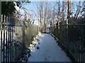
Path to Hillside Avenue
After passing through a Image, the path to Burnbrae turns right (to the north); that section is shown in the present photograph.
From this part of the route, the view to the east, over the railway line, is to the Roads Depot, former site of the Millburn Pyroligneous works; see Image for more information.
Previous: Image
Next: Image
Image: © Lairich Rig
Taken: 30 Nov 2010
0.09 miles
7
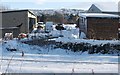
Millburn Roads Depot
This is the view across the railway line towards the depot, as seen from a Image
The site was formerly occupied by Millburn Pyroligneous Works (or Millburn Works), where a process of wood distillation was carried out: wood was heated in the absence of air (rather than being burned) in order to extract useful organic compounds.
Image faces this depot on the other side of the main road (Image).
See http://www.valeofleven.org.uk/pyroligneous.html (at the Vale of Leven website) for a page of old photographs, several of which show the pyroligneous works; for example, in photo 11 on that page, the nearby Image is clearly visible.
About 12km to the north, on east Loch Lomondside, there was a pyroligneous works near Balmaha (Image): see https://canmore.org.uk/site/151458/balmaha-pyroligneous-acid-works (at Canmore).
Image: © Lairich Rig
Taken: 30 Nov 2010
0.09 miles
8
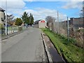
Turnbull Avenue, Burnbrae
The view is from further along the road that is shown in Image At the far right is a railway bridge: Image
Image: © Lairich Rig
Taken: 2 Apr 2017
0.10 miles
9
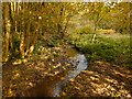
Tributary of the Mill Burn
This is a view upstream. Behind the photographer's position (see Image for a view in that direction), this burn joins the Poachy Burn; they meet just above the Image, forming the Mill Burn.
Image: © Lairich Rig
Taken: 22 Oct 2012
0.10 miles