IMAGES TAKEN NEAR TO
Hawthornhill Road, DUMBARTON, G82 5JE
Introduction
This page details the photographs taken nearby to Hawthornhill Road, G82 5JE by members of the Geograph project.
The Geograph project started in 2005 with the aim of publishing, organising and preserving representative images for every square kilometre of Great Britain, Ireland and the Isle of Man.

There are currently over 7.5m images from over14,400 individuals and you can help contribute to the project by visiting https://www.geograph.org.uk
Image Map
Images are licensed for reuse under creativecommons.org/licenses/by-sa/2.0
Notes
- Clicking on the map will re-center to the selected point.
- The higher the marker number, the further away the image location is from the centre of the postcode.
Image Listing (90 Images Found)
Images are licensed for reuse under creativecommons.org/licenses/by-sa/2.0
Image
Details
Distance
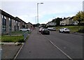
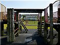
2
Construction at Carrick Terrace
The view is from Cardross Road. Thirty-one homes are being built; in mid-2017, the site was grassy, the earlier houses here having been demolished a few years earlier.
Image: © Lairich Rig
Taken: 7 Sep 2018
0.06 miles
3
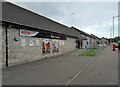
Day-Today
Convenience store on Hawthornhill Road.
Image: © Richard Sutcliffe
Taken: 1 Sep 2023
0.06 miles
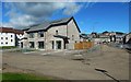
4
Dalreoch United Free Church of Scotland
Another contributor's earlier (2011) picture: Image
Image: © Lairich Rig
Taken: 7 Jun 2020
0.07 miles
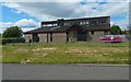
5
Dalreoch United Free Church of Scotland
On Hawthornhill Road.
Image: © Stephen Sweeney
Taken: 23 Mar 2011
0.08 miles
6
Perray Avenue, Hawthornhill
Perray Avenue is a short street attached to the northern side of Hawthornhill Road. About 350 metres to the west are the similarly-named Perrays Way, Drive, Crescent, Grove, and Court.
About 600 metres to the north-west of the point where the photograph was taken is a small square of woodland (Image) called Perrays Wood (visible on the left in Image); this makes the origin of all of these street names clear.
The same Image is mentioned in David Murray's book "Old Cardross: a lecture" (1880), where it is described as "the wood about halfway between Kellochy and Hawthornhill" (Kellochy, now long gone, was at Image; for Hawthornhill, see Image).
The same work adds that "The Perrays" were "the two fields on the north of Hawthornhill, on the east and west of the road to Ardochbeg" (on which, see Image).
Image: © Lairich Rig
Taken: 24 Dec 2010
0.09 miles
7
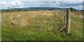
Corner of enclosure
This fenced-off rectangular enclosure, measuring 90 metres by 25, is located just to the west of Knowetop Farm.
For the background hills, see Image; at the right-hand edge of the escarpment, behind a tree and a purple-pink patch of Rosebay Willowherb, is distant Image
Image: © Lairich Rig
Taken: 3 Jun 2009
0.09 miles
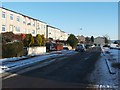
8
A814 Cardross Road
The A814 passing through the western suburbs of Dumbarton.
Image: © David Dixon
Taken: 26 Sep 2019
0.10 miles
9
Play area at Hawthornhill
Being here with family gave an opportunity to show the area; see Image for a less obstructed view.
The buildings in the background are in Westcliff. Image is nearby. See Image for the surroundings.
Image: © Lairich Rig
Taken: 26 Jun 2013
0.10 miles
10
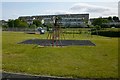
Play area at Hawthornhill
See Image, taken on the same occasion, for comments on the area. The houses in the background are in Westcliff.
Image: © Lairich Rig
Taken: 26 Jun 2013
0.11 miles