
IMAGES TAKEN NEAR TO
Cardross, DUMBARTON, G82 5EP
Introduction
This page details the photographs taken nearby to G82 5EP by members of the Geograph project.
The Geograph project started in 2005 with the aim of publishing, organising and preserving representative images for every square kilometre of Great Britain, Ireland and the Isle of Man.

There are currently over 7.5m images from over14,400 individuals and you can help contribute to the project by visiting https://www.geograph.org.uk
Image Map
Images are licensed for reuse under creativecommons.org/licenses/by-sa/2.0
Notes
- Clicking on the map will re-center to the selected point.
- The higher the marker number, the further away the image location is from the centre of the postcode.
Image Listing (7 Images Found)
Images are licensed for reuse under creativecommons.org/licenses/by-sa/2.0
Image
Details
Distance
1
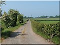
View from sharp bend in the road
The corner from which this photograph was taken is shown here: Image
Image: © Lairich Rig
Taken: 9 Jun 2006
0.03 miles
2
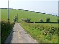
Passing Walton Farm
A farm track connects Kipperoch Farm with Walton Farm; it is part of a longer footpath from Dalmoak to Cardross (see endnote). After passing Walton, the route again becomes a road suitable for vehicles.
Shown here is the point where the road turns sharply towards the west. The view from that corner is shown here: Image
Image: © Lairich Rig
Taken: 9 Jun 2006
0.07 miles
3
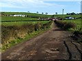
New farm buildings
Walton Farm can be seen on the left, and Walton Cottage on the right, but comparison of this photograph with a similar one that was taken in 2006 (Image) reveals that the buildings in the centre had only recently been built when this picture was taken (in fact, construction work was still taking place in the area in front of them).
Compare Image, which shows the same farm buildings from a different viewpoint.
This road is part of a longer footpath from Dalmoak to Cardross.
Image: © Lairich Rig
Taken: 16 Oct 2009
0.07 miles
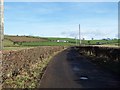
5
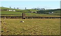
Walton Farm
These farm buildings lie on the Dalmoak to Cardross footpath. This viewpoint is near Bloomhill.
The small brick-built tower is three or four metres tall; it is marked only on large-scale OS mapping from c.1991 or later, but not on maps from c.1980. On those maps where it does appear, it is labelled "Chy", for "Chimney"; I have no more specific information about it.
Image: © Lairich Rig
Taken: 10 Dec 2008
0.13 miles
6
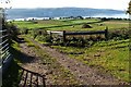
The approach to Walton Farm
This track is part of a footpath between Dalmoak and Cardross (see endnote). This is the downhill stretch that lies beyond the turning in Image
Part of the farm buildings can be seen just above the point where the track curves out of sight.
The line of the route beyond Walton Farm is also visible in this photo; it is bounded by hedges, giving it a dark appearance, and it follows a straight course from the farm building, passing behind the top of the large mound that can be seen in the field.
The River Clyde can be seen in the background, with tower blocks in Port Glasgow visible just left of centre on the far shore.
Later, the blocks shown piled in Image were used to reinforce the track, as shown in Image
Image: © Lairich Rig
Taken: 16 Oct 2009
0.21 miles
7
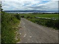
The approach to Walton Farm
The blocks shown piled in Image have been used to reinforce the track, whose earlier appearance is shown in Image
Image: © Lairich Rig
Taken: 22 Jun 2018
0.21 miles