Walton Farm
Introduction
The photograph on this page of Walton Farm by Lairich Rig as part of the Geograph project.
The Geograph project started in 2005 with the aim of publishing, organising and preserving representative images for every square kilometre of Great Britain, Ireland and the Isle of Man.

There are currently over 7.5m images from over 14,400 individuals and you can help contribute to the project by visiting https://www.geograph.org.uk
Walton Farm
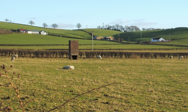
Image: © Lairich Rig Taken: 10 Dec 2008
These farm buildings lie on the Dalmoak to Cardross footpath. This viewpoint is near Bloomhill. The small brick-built tower is three or four metres tall; it is marked only on large-scale OS mapping from c.1991 or later, but not on maps from c.1980. On those maps where it does appear, it is labelled "Chy", for "Chimney"; I have no more specific information about it.
Images are licensed for reuse under creativecommons.org/licenses/by-sa/2.0
Image Location
Latitude
55.959974
Longitude
-4.629972