
IMAGES TAKEN NEAR TO
Tontine Park, DUMBARTON, G82 4LP
Introduction
This page details the photographs taken nearby to Tontine Park, G82 4LP by members of the Geograph project.
The Geograph project started in 2005 with the aim of publishing, organising and preserving representative images for every square kilometre of Great Britain, Ireland and the Isle of Man.

There are currently over 7.5m images from over14,400 individuals and you can help contribute to the project by visiting https://www.geograph.org.uk
Image Map
Images are licensed for reuse under creativecommons.org/licenses/by-sa/2.0
Notes
- Clicking on the map will re-center to the selected point.
- The higher the marker number, the further away the image location is from the centre of the postcode.
Image Listing (159 Images Found)
Images are licensed for reuse under creativecommons.org/licenses/by-sa/2.0
Image
Details
Distance
1

Georgian Postbox
This George VI postbox is situated on the corner of Tontine Park (a street) and Renton Road.
Tontine Park is also the name of this part of Renton. Built in the late 1920s, it retains the name of an original Tontine Park that was located here, and which was the home ground of Renton Football Club.
The present-day park located on the other (i.e. western) side of Renton Road is called Wylie Park.
Image: © Lairich Rig
Taken: 19 Dec 2008
0.07 miles
2
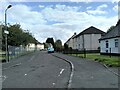
Tontine Park
Residential street in Renton.
Image: © Richard Sutcliffe
Taken: 28 Jul 2023
0.07 miles
3
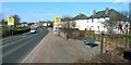
Entering Renton from the south
This view is intended to complement William Craig's earlier photo, Image, which shows more of Image to the left (west) of the main road.
The houses on the right are in the Tontine Park area of Renton. The area in the foreground, on the right, where a bench is visible, was the original site of Renton's War Memorial. Jim Murphy's book "Renton Between the Wars" (2007) provides much information about the history of the monument, only a summary of which is presented below.
The original unveiling ceremony was performed in September, 1922, here at Image After the Second World War, further names were added, and the second unveiling was carried out in November, 1949.
The memorial was later vandalised. Because of this, it was, on October 1, 1988, relocated to a position next to the Smollett Monument, at Image It is shown in its new position in Image For the adjacent monument, see Image
In the present photograph, a dark sign can be seen on the left-hand side of the road, close to the nearest car. That sign says "Welcome to Renton, birthplace of Tobias Smollett"; it has a portrait of Smollett on it (on whom, see the last-cited link, and Image).
[The Howgate, mentioned above, is a track which begins where, in the present photograph, a bus stop can be seen, on the right-hand side of the road, at the speed limit sign; it leads down towards the lower-right corner of the photo, behind the area where the bench is located, and then turns eastward, leading to the River Leven.]
Image: © Lairich Rig
Taken: 24 Mar 2011
0.08 miles

5
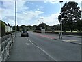
Renton Road
The B857 looking south.
Image: © Richard Sutcliffe
Taken: 28 Jul 2023
0.08 miles
6
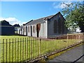
Hall beside John Street
The hall appears (labelled simply "Hall") on the 1936/37 revision of the OS map, but was not present on the 1914 revision. It is now, as it was just before the Second World War, just to the north of a bowling green (Renton Veteran's Bowling Club).
To me, it has the look of a church hall. It was presumably associated with Image: in the late Jim Murphy's very useful book "Renton Between the Wars" (2007), a photograph on page 46 includes this hall, and the accompanying caption states that "the local Parish Church authorities have kindly allowed the veterans the use of the adjoining hall for carpet bowls and social functions".
The white building at the far right was, several decades ago, a clinic, and perhaps still is. A short lane behind (i.e., just south of) that building leads to the main road (Lennox Street). The lane is not named on maps, but in a diagram in the book just cited, it is labelled Scot's Avenue, which was perhaps a nickname of long standing. I suspect (but cannot confirm) that the name is connected to the Scotts who once lived in Dalquhurn Cottage: see Image The lane itself preserves the line of a road that used to lead past Dalquhurn Cottage (as reference to the first-edition OS map, surveyed in 1860, will reveal), and which long pre-dates the nearby present-day John Street.
Image: © Lairich Rig
Taken: 29 Aug 2016
0.08 miles
7
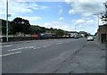
Renton Road
The B857 looking north.
Image: © Richard Sutcliffe
Taken: 28 Jul 2023
0.08 miles
8
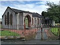
Hall beside John Street and Tontine Park
See Image for Lairich Rig's description of the hall.
Image: © Richard Sutcliffe
Taken: 28 Jul 2023
0.08 miles
9
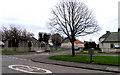
John Street Renton
John Street Renton looking south
Image: © Eddie Mackinnon
Taken: 20 May 2007
0.09 miles
10
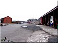
Dalquharn Works Renton
Dalquharn Works Renton once a Cotton Mill and Print and Dye works
Image: © Eddie Mackinnon
Taken: 10 Apr 2006
0.09 miles