
IMAGES TAKEN NEAR TO
Dumbuck Road, DUMBARTON, G82 3NU
Introduction
This page details the photographs taken nearby to Dumbuck Road, G82 3NU by members of the Geograph project.
The Geograph project started in 2005 with the aim of publishing, organising and preserving representative images for every square kilometre of Great Britain, Ireland and the Isle of Man.

There are currently over 7.5m images from over14,400 individuals and you can help contribute to the project by visiting https://www.geograph.org.uk
Image Map
Images are licensed for reuse under creativecommons.org/licenses/by-sa/2.0
Notes
- Clicking on the map will re-center to the selected point.
- The higher the marker number, the further away the image location is from the centre of the postcode.
Image Listing (60 Images Found)
Images are licensed for reuse under creativecommons.org/licenses/by-sa/2.0
Image
Details
Distance
1
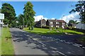
Houses near Barnhill
To some of us, the buildings in this area (at the north-eastern outskirts of Dumbarton) are known informally, on account of their timber cladding, as the Wooden Houses. Argyll Avenue is on the left, with Dumbuck Road branching off to the right.
Image: © Lairich Rig
Taken: 4 Sep 2016
0.03 miles
3
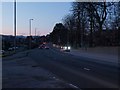
Stirling Road at dusk
The junction of Stirling Road and Dunbritton road is in the foreground. The road here known as Stirling Road is part of the long thoroughfare that carries travellers from the centre of Glasgow to Loch Lomond and on to all of Scotland west and north. It is always more or less always busy, here at dusk just as at most other times.
Image: © Alec MacKinnon
Taken: 4 Mar 2012
0.03 miles
5
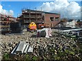
Construction at former site of Crosslet House
Image: © Lairich Rig
Taken: 4 Sep 2016
0.10 miles
6
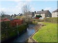
Gruggies Burn
For more information about the burn, see Image
In the present photograph, the backs of houses on Dunbritton Road can be seen on the right; to the left, are those of Strowan's Road. In the distance, near the left-hand edge of the picture, is the dark double-peaked shape of Dumbarton Rock (Image and Image).
See also Image; it was taken from the same point, but is a view in the opposite direction.
Image: © Lairich Rig
Taken: 24 Feb 2011
0.10 miles
8
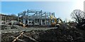
Construction at former site of Crosslet House
A new care home is being built here on the former location of Image The picture was taken from outside the construction site, and shows the southern end of the development (shown from another angle in Image).
Image: © Lairich Rig
Taken: 28 Feb 2016
0.11 miles
9
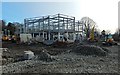
Construction at former site of Crosslet House
A new care home is being built here on the former location of Image The picture was taken from outside the construction site, and shows the southern end of the development (seen from another angle in Image).
Image: © Lairich Rig
Taken: 28 Feb 2016
0.11 miles
10
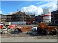
Construction at former site of Crosslet House
Image: © Lairich Rig
Taken: 4 Sep 2016
0.11 miles