
IMAGES TAKEN NEAR TO
Garshake Avenue, DUMBARTON, G82 3LD
Introduction
This page details the photographs taken nearby to Garshake Avenue, G82 3LD by members of the Geograph project.
The Geograph project started in 2005 with the aim of publishing, organising and preserving representative images for every square kilometre of Great Britain, Ireland and the Isle of Man.

There are currently over 7.5m images from over14,400 individuals and you can help contribute to the project by visiting https://www.geograph.org.uk
Image Map
Images are licensed for reuse under creativecommons.org/licenses/by-sa/2.0
Notes
- Clicking on the map will re-center to the selected point.
- The higher the marker number, the further away the image location is from the centre of the postcode.
Image Listing (153 Images Found)
Images are licensed for reuse under creativecommons.org/licenses/by-sa/2.0
Image
Details
Distance
1
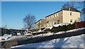
Garshake Avenue, Bellsmyre
The photograph was taken from Garshake Road, which is visible in the foreground, and which forms the boundary of Bellsmyre on this side.
The street comes to a dead end about 150 metres from this junction, but a Image begins there.
The name Garshake, associated with this area, is fairly old. For example, the Pont/Blaeu map of the Lennox (surveyed 1580s-90s) shows "Garshoak" here, next to "Ouertoun". The area of housing on the other side of Garshake Road, behind the photographer's viewpoint, is called High Overtoun. Image is nearby.
The name Garshake was recorded in the form "Gartschavok" in 1466. It is thought to mean "gart (field or enclosure) of the hawk (Gael. 'seabhog')" [Simon Taylor in "Changing Identities, Ancient Roots"].
- - • - -
On a very different note, I will relate here an incident from around the 1990s: the occupant of one of the houses in this area had workmen in to replace his living-room window (a large, front-facing, downstairs window) and his bathroom window (upstairs). I saw for myself the new living-room window that they had installed: it was a huge pane of frosted glass. I did not get to see the new bathroom window, but (as the owner explained) it was of clear glass.
It would take an astonishing level of stupidity to carry out this work without suspecting that something was amiss; to me, it seems more likely that this was an example of "malicious compliance", the workmen following accidentally-garbled instructions, perhaps in the hope that they could get away with charging extra to set things right.
Image: © Lairich Rig
Taken: 2 Dec 2010
0.03 miles
2
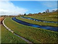
New Dumbarton Cemetery: south-western part
A road (see Image) leading from the main entrance divides the cemetery into a lower or south-western half, shown here, and a higher, north-eastern part. Sections A-G of the cemetery are in this half, and sections H-P in the other.
Image: © Lairich Rig
Taken: 13 Nov 2015
0.04 miles
3
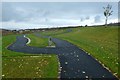
New Dumbarton Cemetery: south-western part
Click on the end-note title for other views.
The present picture, taken on Armistice Day (and before this new cemetery had officially opened), shows its lower part. The lairs are divided into sections A-P; the posts that can be seen in this and other views indicate where these sections are located. The lower half of the cemetery, below the memorial wall, contains sections A-G.
Followed in this direction, the paths lead towards the start of a footpath that winds down the hillside from the north-western extremity of the cemetery, and which leads to Garshake Avenue: Image
Image: © Lairich Rig
Taken: 11 Nov 2015
0.04 miles
4
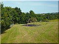
Play area
Image: © Lairich Rig
Taken: 12 Jul 2013
0.04 miles
5
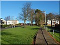
Garshake Road
To the left of the furthest visible part of the road, work was taking place on New Dumbarton Cemetery: Image
Image: © Lairich Rig
Taken: 30 Nov 2014
0.05 miles
6
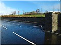
New Dumbarton Cemetery: memorial wall
The wall is on the northern side of the road that leads from the cemetery's lower entrance.
Image: © Lairich Rig
Taken: 13 Nov 2015
0.06 miles
7
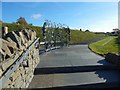
New Dumbarton Cemetery
When this picture was taken, the cemetery had not yet officially opened, but it was no longer fenced off, and the workmen present did not object to my taking some photographs. The pictures I took on this occasion are intended not just to show the new cemetery, but as an acknowledgement of the work that has been put into laying it out.
This was a useful opportunity to document the new cemetery photographically while it was complete, but before any burials had taken place, and before any plaques or other personal mementos had been placed in the two memorial gardens.
The present view is from the vicinity of the SANDS Memorial Garden(*), and the metal screen sculpture visible just ahead is the work of the artist-blacksmith Elspeth Bennie: Image
See Image for a view back towards this area from the far end of the path that can be seen heading off to the right.
Click on the end-note title for other views of the cemetery.
(*) SANDS is the stillbirth & neonatal death charity.
Image: © Lairich Rig
Taken: 30 Oct 2015
0.06 miles
8
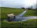
Footpath to New Dumbarton Cemetery
This recently-made path is linked to an existing footpath from Garshake Avenue to Whiteford Crescent (see http://www.geograph.org.uk/snippet/9473 for that path), and leads from either of those streets to the western extremity of New Dumbarton Cemetery, which is further up the slope (see Image for another view).
A storm that had been forecast for the night before, and for the morning when this picture was taken, had amounted to little in this area, although there had been heavy rain and hail only a few minutes earlier. I waited here because I could see that a brief interval of sunshine would soon begin.
There was some cirrus in the sky, and, although no 22° halo could be seen on this occasion (see Image), a circumzenithal arc glowed briefly, almost overhead (compare Image / Image).
I had been keen to document the new cemetery photographically, not only for posterity, but also as a tribute to the work put into laying it out, but only if I could do so before the cemetery came into use; the weather had been unfavourable for weeks (and would continue to be), but this brief period of sunlight between the showers allowed me to obtain the last few pictures I needed.
Image: © Lairich Rig
Taken: 13 Nov 2015
0.06 miles
9
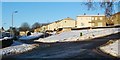
Garshake Terrace, Bellsmyre
Garshake Terrace is the street receding in the left-hand side of the image. In the foreground, Garshake Road leads uphill from the lower-left corner of the photo. (For more on the name Garshake, see Image; that street is the next one up, after Garshake Terrace.)
Visible near the lower-right corner is part of the road of McGregor Drive, in High Overtoun.
Image: © Lairich Rig
Taken: 2 Dec 2010
0.06 miles
10
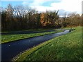
Footpath from New Dumbarton Cemetery
The path was built in connection with nearby New Dumbarton Cemetery, and leads from the cemetery's western extremity towards Garshake Avenue. At its lower end, it also meets a pre-existing Image
See also Image, a view from further up the slope.
Image: © Lairich Rig
Taken: 13 Nov 2015
0.06 miles