IMAGES TAKEN NEAR TO
Dumbarton Road, DUMBARTON, G82 2TZ
Introduction
This page details the photographs taken nearby to Dumbarton Road, G82 2TZ by members of the Geograph project.
The Geograph project started in 2005 with the aim of publishing, organising and preserving representative images for every square kilometre of Great Britain, Ireland and the Isle of Man.

There are currently over 7.5m images from over14,400 individuals and you can help contribute to the project by visiting https://www.geograph.org.uk
Image Map
Images are licensed for reuse under creativecommons.org/licenses/by-sa/2.0
Notes
- Clicking on the map will re-center to the selected point.
- The higher the marker number, the further away the image location is from the centre of the postcode.
Image Listing (69 Images Found)
Images are licensed for reuse under creativecommons.org/licenses/by-sa/2.0
Image
Details
Distance
1
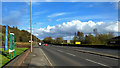
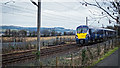
A82 near Milton
The continuation of the Great Western Road from Glasgow on the north side of the Clyde passes a filling station with houses in Milton at the foot of the hillside beyond.
Image: © Andrew Hill
Taken: 16 Jun 2013
0.02 miles
2
Cycle route at Milton
The photograph shows NCN7, with a Travelodge to the left.
Image: © Lairich Rig
Taken: 19 Nov 2010
0.03 miles
3
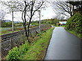
National Cycle Network Route 7 at Milton
Between the railway line and the Travelodge hotel.
Image: © Thomas Nugent
Taken: 27 Apr 2015
0.04 miles
5
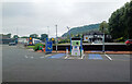
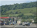
BP Pulse car charging point, Milton
A useful spot between Loch Lomond and Glasgow.
Image: © Hugh Venables
Taken: 7 Sep 2024
0.05 miles
7
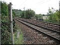
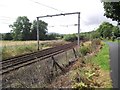
Glasgow to Dumbarton railway
One of two lines that once ran along the narrow corridor between the Clyde and Kilpatrick Hills. The railway serves Helensburgh, Dumbarton, the Vale of Leven and is also used by trains to Fort William and Oban. I used to frequently use this route to get to the hills, but have now been priced off.
Image: © Richard Webb
Taken: 1 Sep 2009
0.06 miles
8
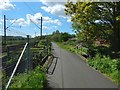
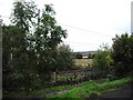
Cycle path crossing the Milton Burn
The main features, as depicted on the 1:25000 map, are shown here: the footpath which is also a cycle path, the course of the burn, and the railway line. Ahead, to the right of the path, is the Image
See Image for a view in the opposite direction.
Image: © Lairich Rig
Taken: 13 May 2018
0.06 miles