IMAGES TAKEN NEAR TO
Dumbarton Road, CLYDEBANK, G81 4DN
Introduction
This page details the photographs taken nearby to Dumbarton Road, G81 4DN by members of the Geograph project.
The Geograph project started in 2005 with the aim of publishing, organising and preserving representative images for every square kilometre of Great Britain, Ireland and the Isle of Man.

There are currently over 7.5m images from over14,400 individuals and you can help contribute to the project by visiting https://www.geograph.org.uk
Image Map
Images are licensed for reuse under creativecommons.org/licenses/by-sa/2.0
Notes
- Clicking on the map will re-center to the selected point.
- The higher the marker number, the further away the image location is from the centre of the postcode.
Image Listing (226 Images Found)
Images are licensed for reuse under creativecommons.org/licenses/by-sa/2.0
Image
Details
Distance
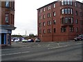
1
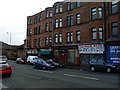
Tenements on Dumbarton Road, Dalmuir
Typical of tenements in Glasgow, in that the flats are on the first floor upwards, and at ground level is a row of shops.
Image: © Stephen Sweeney
Taken: 27 Jan 2008
0.02 miles
2
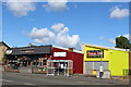
The Cabin Inn, Dumbarton Road, Clydebank
Image: © Leslie Barrie
Taken: 23 Aug 2014
0.02 miles
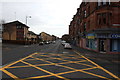
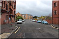
5
Caledonia Street, Dalmuir
Just off Dumbarton Road.
Image: © Stephen Sweeney
Taken: 27 Jan 2008
0.05 miles
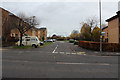
8
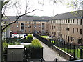
Trafalgar Street
A housing estate between the canal and Dumbarton Road.
Image: © M J Richardson
Taken: 24 Apr 2014
0.06 miles
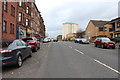
9
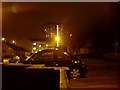
Nairn Place, Dalmuir at night
Looking west to the Dalmuir highrise flats.
Image: © Stephen Sweeney
Taken: 9 Feb 2008
0.06 miles
10
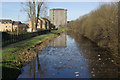
Forth and Clyde Canal, Dalmuir
The Forth and Clyde Canal was opened in 1790 to provide a link between the Forth at Grangemouth and the Clyde at Bowling. There is also a branch to Port Dundas in Glasgow. The canal was closed to commercial traffic in 1963 after a long decline and fell into a derelict state; it has now been restored although the debris in the water here suggests boats are few and far between.
Image: © Stephen McKay
Taken: 19 Mar 2008
0.07 miles