IMAGES TAKEN NEAR TO
Boquhanran Place, CLYDEBANK, G81 3BG
Introduction
This page details the photographs taken nearby to Boquhanran Place, G81 3BG by members of the Geograph project.
The Geograph project started in 2005 with the aim of publishing, organising and preserving representative images for every square kilometre of Great Britain, Ireland and the Isle of Man.

There are currently over 7.5m images from over14,400 individuals and you can help contribute to the project by visiting https://www.geograph.org.uk
Image Map
Images are licensed for reuse under creativecommons.org/licenses/by-sa/2.0
Notes
- Clicking on the map will re-center to the selected point.
- The higher the marker number, the further away the image location is from the centre of the postcode.
Image Listing (53 Images Found)
Images are licensed for reuse under creativecommons.org/licenses/by-sa/2.0
Image
Details
Distance
1
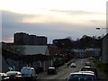
Westward view of Second Avenue
Looking to the highrise flats in Dalmuir.
Image: © Stephen Sweeney
Taken: 9 Apr 2008
0.06 miles
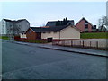
2
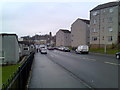
Second Avenue, Clydebank
Looking to St Stephen's Court and St Stephens Church.
Image: © Stephen Sweeney
Taken: 30 Dec 2007
0.06 miles
3
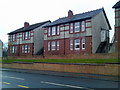
Second Avenue housing
There is such a variation in housing quality on Second Avenue - this is more the upper end of the market.
Image: © Stephen Sweeney
Taken: 30 Dec 2007
0.07 miles
4
Looking to Singer football pitches
From Second Avenue at Boquhanran Road.
Image: © Stephen Sweeney
Taken: 30 Dec 2007
0.08 miles
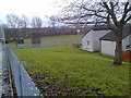
5
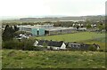
Clydebank High School
Seen from Boquhanran Park.
Image: © Richard Sutcliffe
Taken: 29 Apr 2021
0.10 miles
6
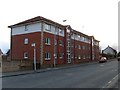
New housing on Second Avenue
There has been much development of Second Avenue in the last fifteen years.
Image: © Stephen Sweeney
Taken: 9 Apr 2008
0.11 miles
7
Underpass for the railway
A low and narrow path under the Singer to Dalmuir railway line at Singer Road. A continuation of Boquhanran Road, leading to Second Avenue.
Image: © M J Richardson
Taken: 24 Apr 2014
0.12 miles
8
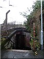
Subway under railway line in Clydebank
On Boquhanran Road.
Image: © Stephen Sweeney
Taken: 30 Mar 2008
0.12 miles
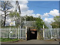
9
Barns o' Clyde Lodge, Clydebank
The name Barns o' Clyde was the original name of the farming area that would become the town of Clydebank.
Image: © Stephen Sweeney
Taken: 30 Dec 2007
0.12 miles
10
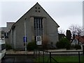
Radnor Park Congregational Church
This church was built in 1961 as a replacement for one of the same name which was damaged in the Clydebank Blitz of 1941.
Image: © Stephen Sweeney
Taken: 30 Mar 2008
0.12 miles