IMAGES TAKEN NEAR TO
Muirhead Road, GLASGOW, G78 4DA
Introduction
This page details the photographs taken nearby to Muirhead Road, G78 4DA by members of the Geograph project.
The Geograph project started in 2005 with the aim of publishing, organising and preserving representative images for every square kilometre of Great Britain, Ireland and the Isle of Man.

There are currently over 7.5m images from over14,400 individuals and you can help contribute to the project by visiting https://www.geograph.org.uk
Image Map
Images are licensed for reuse under creativecommons.org/licenses/by-sa/2.0
Notes
- Clicking on the map will re-center to the selected point.
- The higher the marker number, the further away the image location is from the centre of the postcode.
Image Listing (13 Images Found)
Images are licensed for reuse under creativecommons.org/licenses/by-sa/2.0
Image
Details
Distance
1
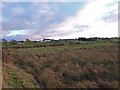
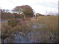
Fields, East Uplaw Farm
Uncultivated field near the dismantled railway line Uplawmoor.
Image: © wfmillar
Taken: 16 Dec 2009
0.07 miles
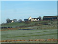
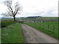
3
Mid Uplaw
Farm to the east of Uplawmoor.
Image: © Stephen Sweeney
Taken: 29 Oct 2014
0.09 miles
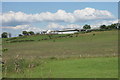
4
Mid Uplaw farm near Uplawmoor
A working farm, not far from the edge of the greater Glasgow conurbation
Image: © James Allan
Taken: 25 Dec 2005
0.13 miles
5
Flooded Corner
Adjacent to Uplawmoor/Neilston Road, this field corner looks like it is flooded most of the year.
Image: © wfmillar
Taken: 16 Dec 2009
0.13 miles
7
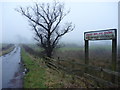
Rural East Renfrewshire : East Uplaw Road-end
A dreich morning near Uplawmoor.
Image: © Richard West
Taken: 8 Jan 2012
0.17 miles
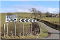
8
Minor Road east of Uplawmoor
The attractive village of Uplawmoor can be seen in the valley below.
Image: © G Laird
Taken: 2 May 2014
0.20 miles
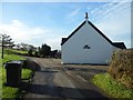
9
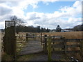
Rural East Renfrewshire : Gates On The Castburn Path, Uplawmoor
Image: © Richard West
Taken: 26 Mar 2013
0.21 miles
10
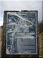
Rural East Renfrewshire : Aged And Worn Sign On The Castburn Path, Uplawmoor
This sign appears to date from the late 1980's and describes the "Glasgow and Irvine Railway Path and Cycleroute", a route that is a good few miles to the west of this location.
Image: © Richard West
Taken: 26 Mar 2013
0.21 miles