
IMAGES TAKEN NEAR TO
Neilston, GLASGOW, G78 3DW
Introduction
This page details the photographs taken nearby to G78 3DW by members of the Geograph project.
The Geograph project started in 2005 with the aim of publishing, organising and preserving representative images for every square kilometre of Great Britain, Ireland and the Isle of Man.

There are currently over 7.5m images from over14,400 individuals and you can help contribute to the project by visiting https://www.geograph.org.uk
Image Map
Images are licensed for reuse under creativecommons.org/licenses/by-sa/2.0
Notes
- Clicking on the map will re-center to the selected point.
- The higher the marker number, the further away the image location is from the centre of the postcode.
Image Listing (9 Images Found)
Images are licensed for reuse under creativecommons.org/licenses/by-sa/2.0
Image
Details
Distance
1
Muirhead Farm
Mainly sheep farming around here.
Image: © wfmillar
Taken: 8 Feb 2012
0.07 miles
2
Muirhead Farmland
Looking across mainly sheep grazing land towards North Walton Farm. Dodd Hill with the trees on it, above the farm .
Image: © wfmillar
Taken: 8 Feb 2012
0.08 miles
3
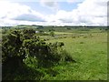
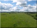
Pasture, Dyke Hill
Igneous uplands near Neilston.
Image: © Richard Webb
Taken: 25 Jun 2016
0.12 miles
5
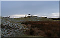
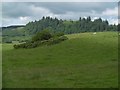
Two Hawthorn Trees
Rough land near Dyke Hill
Image: © wfmillar
Taken: 8 Feb 2012
0.16 miles
7
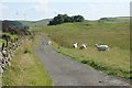
Road to Snypes Dam
Grazing sheep wander beside the single-track road. The wind turbines in the distance are part of the Middleton Wind Farm.
Image: © Richard Sutcliffe
Taken: 18 Jul 2017
0.24 miles
8
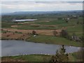
Neilston countryside
This view looks east from the top of Neilston Pad over several of the farms in the area, towards Newton Mearns in the distance. Snypes Dam (Image) is in the foreground, and Walton Dam (e.g. Image) beyond.
Image: © Alec MacKinnon
Taken: 1 Apr 2012
0.24 miles
9
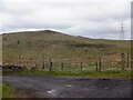
Dyke Hill
Recently planted with trees.
Image: © Richard Webb
Taken: 27 Apr 2021
0.25 miles