IMAGES TAKEN NEAR TO
Craigton Road, GLASGOW, G77 6ZP
Introduction
This page details the photographs taken nearby to Craigton Road, G77 6ZP by members of the Geograph project.
The Geograph project started in 2005 with the aim of publishing, organising and preserving representative images for every square kilometre of Great Britain, Ireland and the Isle of Man.

There are currently over 7.5m images from over14,400 individuals and you can help contribute to the project by visiting https://www.geograph.org.uk
Image Map
Images are licensed for reuse under creativecommons.org/licenses/by-sa/2.0
Notes
- Clicking on the map will re-center to the selected point.
- The higher the marker number, the further away the image location is from the centre of the postcode.
Image Listing (10 Images Found)
Images are licensed for reuse under creativecommons.org/licenses/by-sa/2.0
Image
Details
Distance
1
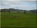
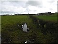
Fields off Dodside Road
Igneous uplands south of Barrhead with Middleton wind farm on the skyline.
Image: © Richard Webb
Taken: 25 Sep 2015
0.13 miles
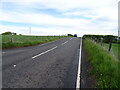
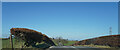
3
B769 near Newton Mearns
Craigton Road junction.
Image: © wfmillar
Taken: 20 May 2011
0.15 miles
4
Fields off Dodside Road
A few months after Image and a silage crop has been taken.
Image: © Richard Webb
Taken: 25 Jun 2016
0.17 miles
5
Fields off Dodside Road
Damp looking, but this was during a dry spell. The rain of litter never seems to dry up though.
Image: © Richard Webb
Taken: 25 Sep 2015
0.17 miles
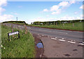
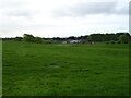
6
The B769
The fields here look much greener than those even a few hundred yards behind.
Image: © Malcolm Neal
Taken: 20 Mar 2022
0.17 miles
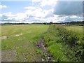
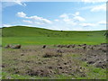
7
Grazing towards Cairnrie Farm
Off the B769.
Image: © JThomas
Taken: 24 May 2021
0.19 miles
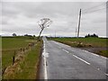
8
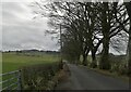
Tree-lined Craigton Road
This single-track country road runs roughly west across farmland from the Newton Mearns-Stewarton Road. Here it is seen just east of the bridge over the Brock Burn.
Image: © Alec MacKinnon
Taken: 22 Mar 2021
0.22 miles
10
Mixed textures
Differing textures of farmland near the road into Faulds farm.
Image: © James Allan
Taken: 1 Jun 2012
0.24 miles