IMAGES TAKEN NEAR TO
Eaglesham, GLASGOW, G76 0PT
Introduction
This page details the photographs taken nearby to G76 0PT by members of the Geograph project.
The Geograph project started in 2005 with the aim of publishing, organising and preserving representative images for every square kilometre of Great Britain, Ireland and the Isle of Man.

There are currently over 7.5m images from over14,400 individuals and you can help contribute to the project by visiting https://www.geograph.org.uk
Image Map
Images are licensed for reuse under creativecommons.org/licenses/by-sa/2.0
Notes
- Clicking on the map will re-center to the selected point.
- The higher the marker number, the further away the image location is from the centre of the postcode.
Image Listing (16 Images Found)
Images are licensed for reuse under creativecommons.org/licenses/by-sa/2.0
Image
Details
Distance
1
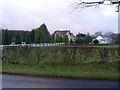
Waterlogged field
On the south side of Humbie Road, looking roughly west towards Castlehill House.
Image: © Alec MacKinnon
Taken: 30 Jan 2021
0.03 miles
2
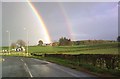
Castlehill rainbow
A double rainbow strikes on Castlehill after April showers.
Image: © Kenneth Mallard
Taken: 30 Apr 2010
0.03 miles
3
One Hole
Private one hole golf course at Castlehill Farm
Image: © Iain Thompson
Taken: 19 Nov 2005
0.04 miles
4
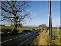
Humbie Road at Castlehill Farm
The picture looks west along the Humbie Road from near the Castlehill Farm road end, towards the roundabout at Bonnyton Moor Road.
Image: © Alec MacKinnon
Taken: 30 Jan 2021
0.05 miles
5
Approaching the roundabout on Humbie Road
From the east.
Image: © Stephen Sweeney
Taken: 17 Nov 2009
0.06 miles
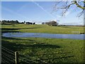
6
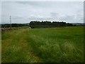
Pasture, Castlehill
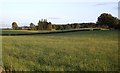
A field by Eaglesham, within earshot of the A726.
Image: © Richard Webb
Taken: 28 Aug 2016
0.07 miles
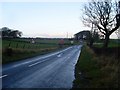
7
Castlehill Farm
On the road between Newton Mearns and Eaglesham.
Image: © Stephen Sweeney
Taken: 17 Nov 2009
0.08 miles
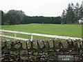
8
Castlehill
A semi natural knoll, 70m in diameter at the base and 3m high, bearing evidence of modification as a motte near Castlehill Farm was identified in 1978. However recent investigations undertaken in 2007 suggest it is entirely natural and there is no evidence that its top or sides have been modified to form a motte. Other motte sites associated with the Montgomeries can be found at Polnoon Castle http://www.geograph.org.uk/photo/1480519 and at Motte Hill http://www.geograph.org.uk/photo/1450316 .
Image: © Kenneth Mallard
Taken: 9 Sep 2009
0.08 miles
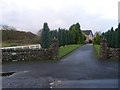
9
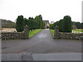
Entrance to Castlehill Farm
On Humbie Road near Eaglesham.
Image: © G Laird
Taken: 3 Jan 2013
0.09 miles