IMAGES TAKEN NEAR TO
Windward Road, GLASGOW, G75 8NS
Introduction
This page details the photographs taken nearby to Windward Road, G75 8NS by members of the Geograph project.
The Geograph project started in 2005 with the aim of publishing, organising and preserving representative images for every square kilometre of Great Britain, Ireland and the Isle of Man.

There are currently over 7.5m images from over14,400 individuals and you can help contribute to the project by visiting https://www.geograph.org.uk
Image Map
Images are licensed for reuse under creativecommons.org/licenses/by-sa/2.0
Notes
- Clicking on the map will re-center to the selected point.
- The higher the marker number, the further away the image location is from the centre of the postcode.
Image Listing (8 Images Found)
Images are licensed for reuse under creativecommons.org/licenses/by-sa/2.0
Image
Details
Distance
1
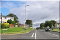
Junction of Windward Road and Westwood Road, East Kilbride
Image: © Elliott Simpson
Taken: 5 Aug 2011
0.05 miles
2
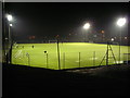
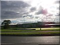
Floodlit Duncanrig Playing Fields
Part of Duncanrig School and Sports Centre
Image: © Iain Thompson
Taken: 18 Dec 2007
0.08 miles
3
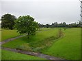
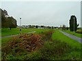
Stream and park in Westwoodhill, East Kilbride
Image: © Stephen Sweeney
Taken: 5 Jul 2012
0.09 miles
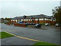
4
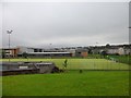
Duncanrig Secondary School, East Kilbride
From Westwood Road.
Image: © Stephen Sweeney
Taken: 5 Jul 2012
0.11 miles
5
Duncanrig Secondary School, East Kilbride
Image: © Elliott Simpson
Taken: 5 Aug 2011
0.14 miles
6
Westwood
View across to the football pitches in Westwood.
Image: © Andy Farrington
Taken: 8 Oct 2011
0.17 miles
7
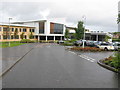
Duncanrig Secondary School
A new school building officially opened in 2008 built on the site of the playing fields of the original building.
Image: © G Laird
Taken: 2 Oct 2012
0.17 miles
8
Abbey Lodge Care Home
View of this care home on the corner of Mossneuk Road and Westwood Hill in East Kilbride.
Image: © Andy Farrington
Taken: 8 Oct 2011
0.24 miles