IMAGES TAKEN NEAR TO
Uddingston, GLASGOW, G71 7RR
Introduction
This page details the photographs taken nearby to G71 7RR by members of the Geograph project.
The Geograph project started in 2005 with the aim of publishing, organising and preserving representative images for every square kilometre of Great Britain, Ireland and the Isle of Man.

There are currently over 7.5m images from over14,400 individuals and you can help contribute to the project by visiting https://www.geograph.org.uk
Image Map
Images are licensed for reuse under creativecommons.org/licenses/by-sa/2.0
Notes
- Clicking on the map will re-center to the selected point.
- The higher the marker number, the further away the image location is from the centre of the postcode.
Image Listing (9 Images Found)
Images are licensed for reuse under creativecommons.org/licenses/by-sa/2.0
Image
Details
Distance
1
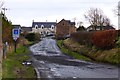
Townfoot Farm
Original name was Blantyre Farm/Ferme.
Image: © Robert Murray
Taken: 25 Feb 2016
0.04 miles
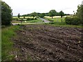
4
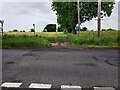
NCR 75 entrance
Heading off Blantyre Farm Road towards Uddingston
Image: © Jim Smillie
Taken: 9 Jun 2022
0.21 miles
5
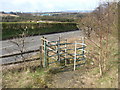
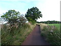
Clyde Walkway enters Brickworks Hill woodland
This photo was taken while following the Clyde Walkway eastwards; on the other side of the road (Blantyre Farm Road), the corner of a field can be seen. The Walkway follows the edge of the field until it meets the main road (see Image); it then turns south to follow that road for a few yards, before crossing to the gate shown here, which marks the point where the Clyde Walkway enters an area of woodland called Brickworks Hill. I have turned around to show the section of the Walkway that leads to this point.
This 13 hectare site formerly contained brickworks and slag heaps, but was reshaped into a hill and partially planted in 1976. In 1993, it became part of Blantyreferme Community Woodland.
Image: © Lairich Rig
Taken: 8 Apr 2005
0.21 miles
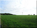
6
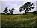
View to field boundary
Now separating parts of larger field
Image: © Jim Smillie
Taken: 9 Jun 2022
0.22 miles
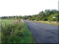
8
Recently cleared wooded area
Making the entrance to Redlees car park visible
Image: © Jim Smillie
Taken: 9 Jun 2022
0.25 miles
9
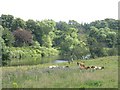
Riverside pasture opposite Uddingston
Ayrshire cattle amongst grass and various weeds beside the Clyde. Impressionists would have thrived in Lanarkshire - there is a cracking railway bridge just downstream too.
Image: © Richard Webb
Taken: 25 Jul 2008
0.25 miles