Clyde Walkway enters Brickworks Hill woodland
Introduction
The photograph on this page of Clyde Walkway enters Brickworks Hill woodland by Lairich Rig as part of the Geograph project.
The Geograph project started in 2005 with the aim of publishing, organising and preserving representative images for every square kilometre of Great Britain, Ireland and the Isle of Man.

There are currently over 7.5m images from over 14,400 individuals and you can help contribute to the project by visiting https://www.geograph.org.uk
Clyde Walkway enters Brickworks Hill woodland
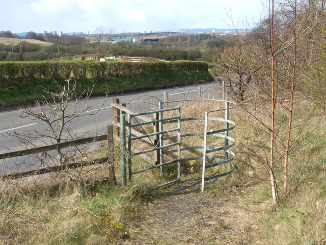
Image: © Lairich Rig Taken: 8 Apr 2005
This photo was taken while following the Clyde Walkway eastwards; on the other side of the road (Blantyre Farm Road), the corner of a field can be seen. The Walkway follows the edge of the field until it meets the main road (see Image); it then turns south to follow that road for a few yards, before crossing to the gate shown here, which marks the point where the Clyde Walkway enters an area of woodland called Brickworks Hill. I have turned around to show the section of the Walkway that leads to this point. This 13 hectare site formerly contained brickworks and slag heaps, but was reshaped into a hill and partially planted in 1976. In 1993, it became part of Blantyreferme Community Woodland.
Images are licensed for reuse under creativecommons.org/licenses/by-sa/2.0
Image Location
Latitude
55.820079
Longitude
-4.104392