
IMAGES TAKEN NEAR TO
Aitkenhead Road, GLASGOW, G71 5PP
Introduction
This page details the photographs taken nearby to Aitkenhead Road, G71 5PP by members of the Geograph project.
The Geograph project started in 2005 with the aim of publishing, organising and preserving representative images for every square kilometre of Great Britain, Ireland and the Isle of Man.

There are currently over 7.5m images from over14,400 individuals and you can help contribute to the project by visiting https://www.geograph.org.uk
Image Map
Images are licensed for reuse under creativecommons.org/licenses/by-sa/2.0
Notes
- Clicking on the map will re-center to the selected point.
- The higher the marker number, the further away the image location is from the centre of the postcode.
Image Listing (12 Images Found)
Images are licensed for reuse under creativecommons.org/licenses/by-sa/2.0
Image
Details
Distance
1
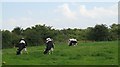
Grazing Friesians, Aitkenhead
Lanarkshire is a dairy farming region, although much of the land around here is industrial.
Image: © Richard Webb
Taken: 25 Jul 2008
0.03 miles
3
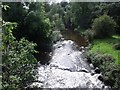
North Calder Water
As it passes in a meander beneath Aikenhead Farm.
Image: © Robert Murray
Taken: 9 Sep 2009
0.15 miles
4
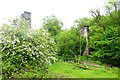
Viaduct Piers
Built in 1866 this bridge carried the Nackerty branch of the Caledonian Railway from the main Rutherglen to Coatbridge line across the valley of the North Calder to the coal pits around the village of Nackerty - which is now present day Tannochside. It was dismantled in the late 1960s.
Image: © Robert Murray
Taken: 16 Jun 2015
0.21 miles
5
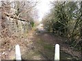
Old Road at Aitkenhead
This road was formerly the B757 before this section was closed. The new A752 was aligned along a more direct route.
The structure to the left is an embankment of the Bredisholm mineral railway which looped off the NBR Shettleston Bothwell line in the south and connected with the Caldedonian Railway's Rutherglen to Coatbridge branch, servicing the pits in between up till 1934 when the last one closed. See also www.geograph.org.uk/photo/1758599
Image: © Robert Murray
Taken: 17 Mar 2010
0.21 miles
6
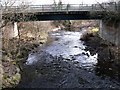
Bridge over Calder Water
This bridge takes the A752 Gartcosh to Uddingston road across the North Calder at Aitkenhead, it replaced the Aitkenhead bridge (which the photographer took the photo from) in the early 1970s.
Image: © Robert Murray
Taken: 17 Mar 2010
0.21 miles
7
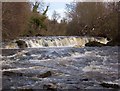
The six foot waterfall
The North Calder in spate. The keen eye will observe an upturned dinghy which may be a relic of a foolish attempt by local youths to 'shoot' the falls.
Image: © Robert Murray
Taken: 26 Apr 2005
0.22 miles
8
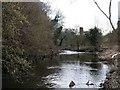
North Calder Water at Braehead
Slowly meandering towards the twin columns of the Tannochside Branch railway viaduct.
Image: © Robert Murray
Taken: 17 Mar 2010
0.22 miles
9
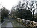
The Old Aitkenhead Bridge
A double arched span bridge which carried the B757 over the North Calder. The abutment of the viaduct which carried Bredisholm Railway over the river here is on the left. See also www.geograph.org.uk/photo/1758591
Image: © Robert Murray
Taken: 17 Mar 2010
0.22 miles
10
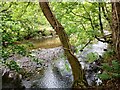
North Calder Water
Appears fairly shallow at this time
Image: © Jim Smillie
Taken: 30 Aug 2022
0.23 miles