IMAGES TAKEN NEAR TO
Muckcroft Road, GLASGOW, G69 0JJ
Introduction
This page details the photographs taken nearby to Muckcroft Road, G69 0JJ by members of the Geograph project.
The Geograph project started in 2005 with the aim of publishing, organising and preserving representative images for every square kilometre of Great Britain, Ireland and the Isle of Man.

There are currently over 7.5m images from over14,400 individuals and you can help contribute to the project by visiting https://www.geograph.org.uk
Image Map
Images are licensed for reuse under creativecommons.org/licenses/by-sa/2.0
Notes
- Clicking on the map will re-center to the selected point.
- The higher the marker number, the further away the image location is from the centre of the postcode.
Image Listing (9 Images Found)
Images are licensed for reuse under creativecommons.org/licenses/by-sa/2.0
Image
Details
Distance
1
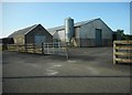
Braeside Farm
Beside Muckcroft Road.
Image: © Richard Sutcliffe
Taken: 18 Sep 2020
0.01 miles
2
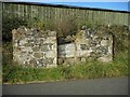
Remains of old farm building
This is a small part of the original East Muckcroft, of which only a small amount remains within the more recent Braeside Farm on the same site Image
Image: © Richard Sutcliffe
Taken: 18 Sep 2020
0.04 miles
3
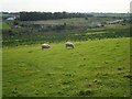
Grazing sheep
In the distance is the M80 motorway, crossed by Auchengeich Road.
Image: © Richard Sutcliffe
Taken: 18 Sep 2020
0.04 miles
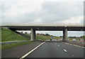
5
North Lanarkshire : The M80 Motorway
Heading along the M80 Motorway.
Image: © Lewis Clarke
Taken: 25 Apr 2016
0.15 miles
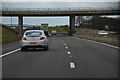
6
M80 east under Auchengeich road bridge
M73 junction sign can be seen through bridge
Image: © John Firth
Taken: 13 May 2012
0.16 miles
7
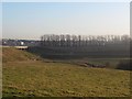
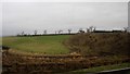
New section of the M80 from Muckcroft Road
Completed in 2011, this section of the M80 bypasses the towns of Chryston and Moodiesburn, which are seen in the distant left of the image.
Image: © Stephen Sweeney
Taken: 15 Dec 2011
0.17 miles
8
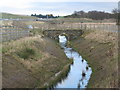
Footbridge over a tributary of the Bothlin Burn
This tributary had to be realigned following the construction of the M80, which can be seen to the left of the photograph.
Image: © G Laird
Taken: 2 Jan 2014
0.19 miles
9
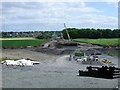
Auchengeich Road
The (now old) road to Auchengeich but now a building site for the new route of the M80 motorway north of Moodiesburn and the old colliery called the 'Geich'.
Image: © Robert Murray
Taken: 12 Jun 2010
0.19 miles