IMAGES TAKEN NEAR TO
Kirkintilloch, GLASGOW, G66 5LW
Introduction
This page details the photographs taken nearby to G66 5LW by members of the Geograph project.
The Geograph project started in 2005 with the aim of publishing, organising and preserving representative images for every square kilometre of Great Britain, Ireland and the Isle of Man.

There are currently over 7.5m images from over14,400 individuals and you can help contribute to the project by visiting https://www.geograph.org.uk
Image Map
Images are licensed for reuse under creativecommons.org/licenses/by-sa/2.0
Notes
- Clicking on the map will re-center to the selected point.
- The higher the marker number, the further away the image location is from the centre of the postcode.
Image Listing (13 Images Found)
Images are licensed for reuse under creativecommons.org/licenses/by-sa/2.0
Image
Details
Distance
1
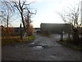
Sauchenhall Farm
Between Kirkintilloch and Cumbernauld.
Image: © Stephen Sweeney
Taken: 15 Dec 2011
0.03 miles
2
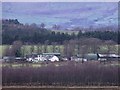
Sauchenhall Farm
Exclusively a riding school business these days.
Image: © Robert Murray
Taken: 16 Dec 2009
0.04 miles
3
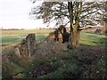
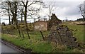
Playhill Ruins
This ruin was once a cottage - or row of - called Playhill. The name is still to be found on the O.S. maps. Across the road is Sauchenhall Riding School.
Image: © Robert Murray
Taken: 8 Nov 2009
0.05 miles
4
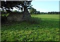
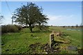
Ruined building
At the edge of the field.
Image: © Richard Sutcliffe
Taken: 18 Sep 2020
0.08 miles
7
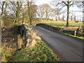
Road Bridge over Luggie Water
Looking north on a minor road south east of Kirkintilloch.
Image: © G Laird
Taken: 8 Jan 2014
0.16 miles
8
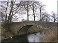
Like a Bridge Over Luggie Water
Note the rather attractive mattress feature, bottom left.
Image: © Chris Upson
Taken: 26 Feb 2006
0.16 miles
9
Mossfinnan (remains)
1864 OS maps show a four compartment roofed building in this area.
It is now simply a ruin although an oblong feature is evident
and the rubble walls can still be seen strewn all around.
Image: © Texas Radio and The Big Beat
Taken: 10 Apr 2010
0.20 miles
10
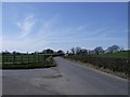
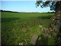
In the Luggie Valley
This 'C' road services the farms and rural dwellings in the area between Mollinsburn and Kirkintilloch.
Image: © Robert Murray
Taken: 10 Apr 2010
0.21 miles