IMAGES TAKEN NEAR TO
Kilsyth, GLASGOW, G65 0QD
Introduction
This page details the photographs taken nearby to G65 0QD by members of the Geograph project.
The Geograph project started in 2005 with the aim of publishing, organising and preserving representative images for every square kilometre of Great Britain, Ireland and the Isle of Man.

There are currently over 7.5m images from over14,400 individuals and you can help contribute to the project by visiting https://www.geograph.org.uk
Image Map
Images are licensed for reuse under creativecommons.org/licenses/by-sa/2.0
Notes
- Clicking on the map will re-center to the selected point.
- The higher the marker number, the further away the image location is from the centre of the postcode.
Image Listing (62 Images Found)
Images are licensed for reuse under creativecommons.org/licenses/by-sa/2.0
Image
Details
Distance
1
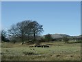
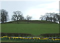
On a ridge at Townhead Farm
The remains of cut down trees lie in the field.
Image: © Robert Murray
Taken: 30 Jan 2010
0.08 miles
3
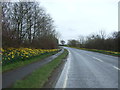
Stirling Road (A803)
Heading south east towards Bonnybridge.
Image: © JThomas
Taken: 30 Mar 2017
0.10 miles
4
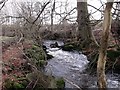
Shawend Burn at Townhead Farm
A channel of the main lade rejoins the burn.
Image: © Robert Murray
Taken: 21 Jan 2010
0.10 miles
5
Grazing, Shawend
Looking south from Stirling Road (A803).
Image: © JThomas
Taken: 30 Mar 2017
0.12 miles
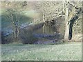
6
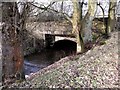
Bridge over the old A803
Now disused since the main trunk road was diverted slightly. The Shawend burn flows under this structure which looks as if it has been altered over the years.
Image: © Robert Murray
Taken: 21 Jan 2010
0.12 miles
7
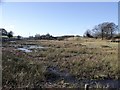
Wetland between drumlins
On the north side of the A803 Kilsyth to Banknock road.
Image: © Robert Murray
Taken: 30 Jan 2010
0.13 miles
8
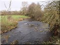
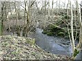
Shawend Burn
Who says this is a burn? Don't fall in when it's full of snow melt off the Campsies.
Image: © Robert Murray
Taken: 21 Jan 2010
0.15 miles
9
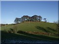
Colziumbea Plantation
This little hill (summit,75m) was called 'Collanbe' by Timothy Pont on his map of the area c.1590. See www.canmore.rcahms.gov.uk/en/site/45887/details/colziumbea/ for RCHAMS record.
Image: © Robert Murray
Taken: 30 Jan 2010
0.15 miles
10
The Shawend Burn
Low level of water in this shot from the high ground above.
Image: © Robert Murray
Taken: 30 Jan 2010
0.15 miles