IMAGES TAKEN NEAR TO
Balfron Station, GLASGOW, G63 0QY
Introduction
This page details the photographs taken nearby to G63 0QY by members of the Geograph project.
The Geograph project started in 2005 with the aim of publishing, organising and preserving representative images for every square kilometre of Great Britain, Ireland and the Isle of Man.

There are currently over 7.5m images from over14,400 individuals and you can help contribute to the project by visiting https://www.geograph.org.uk
Image Map
Images are licensed for reuse under creativecommons.org/licenses/by-sa/2.0
Notes
- Clicking on the map will re-center to the selected point.
- The higher the marker number, the further away the image location is from the centre of the postcode.
Image Listing (9 Images Found)
Images are licensed for reuse under creativecommons.org/licenses/by-sa/2.0
Image
Details
Distance
1
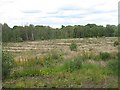
Garchell Wood
Large clear felled area beside the B835.
Image: © Richard Webb
Taken: 11 Jun 2009
0.13 miles
2
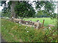
Border Leicester sheep
At Garshell farm - Leicester sheep are famous for their Roman nose
Image: © Eirian Evans
Taken: 9 Sep 2021
0.16 miles
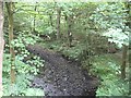
4
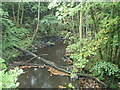
Auchentroig Burn
West of Buchlyvie, flowing towards Flanders Moss and eventual confluence with the River Forth
Image: © Eirian Evans
Taken: 9 Sep 2021
0.20 miles
5
Arnfechlach Bridge
A small Bridge crossing Auchentroig Burn on the Parish road from Gartmore to Buchlyvie
Image: © Eirian Evans
Taken: 9 Sep 2021
0.20 miles
6
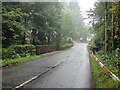
B835
Minor road descending past Ward Toll Wood to cross the Pundy Burn.
Image: © Richard Webb
Taken: 11 Jun 2009
0.20 miles
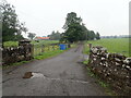
7
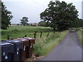
Entrance to Garshell Farm
Wheelie bins lining the country roads of Stirlingshire
Image: © Angela Mudge
Taken: 10 Jul 2006
0.23 miles
8
Auchentroig Burn
Burn flowing towards Flanders Moss. View from the B835.
Image: © Richard Webb
Taken: 11 Jun 2009
0.23 miles
9
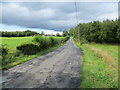
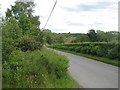
Road (B835) approaching Ward Toll Wood
Looking north-westward.
Image: © Peter Wood
Taken: 4 Sep 2022
0.24 miles