
IMAGES TAKEN NEAR TO
Braid Street, GLASGOW, G4 9YA
Introduction
This page details the photographs taken nearby to Braid Street, G4 9YA by members of the Geograph project.
The Geograph project started in 2005 with the aim of publishing, organising and preserving representative images for every square kilometre of Great Britain, Ireland and the Isle of Man.

There are currently over 7.5m images from over14,400 individuals and you can help contribute to the project by visiting https://www.geograph.org.uk
Image Map
Images are licensed for reuse under creativecommons.org/licenses/by-sa/2.0
Notes
- Clicking on the map will re-center to the selected point.
- The higher the marker number, the further away the image location is from the centre of the postcode.
Image Listing (147 Images Found)
Images are licensed for reuse under creativecommons.org/licenses/by-sa/2.0
Image
Details
Distance
2
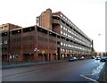
Woodside Library and Learning Centre
Image: © Thomas Nugent
Taken: 13 Feb 2009
0.07 miles
3
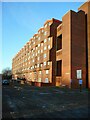
Flats on Raglan Street
In full sunshine on a cold, but sunny December morning.
Image: © Richard Sutcliffe
Taken: 9 Dec 2022
0.08 miles
4
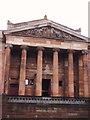
St. George's In The Fields Church
The carvings above the pillars depicts "Christ feeding the multitude".
Image: © Lynn M Reid
Taken: 24 Mar 2008
0.08 miles
5
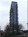
Torridon Court towerblock
On Cedar Street, near St George's Cross.
Image: © Thomas Nugent
Taken: 13 Feb 2009
0.08 miles
6
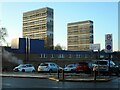
Tower blocks on Cedar Street
Katrine Court (left) and Torridon Court (right) seen from Garscube Road. Part of the Barr Street Health Centre is in the foreground.
Image: © Richard Sutcliffe
Taken: 9 Dec 2022
0.08 miles
7
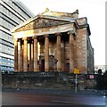
St George's in the Fields
The former St George's in the Fields church. The church was built in 1885-6 and is Category A listed http://portal.historicenvironment.scot/designation/LB33782. It was converted to housing in 1988-9.
Image: © Richard Sutcliffe
Taken: 9 Dec 2022
0.09 miles
8
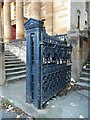
Ornamental gate
Decorative gate at the front of the former St George's in the Fields church. The church was built in 1885-6 and is Category A listed http://portal.historicenvironment.scot/designation/LB33782. It was converted to housing in 1988-9.
Image: © Richard Sutcliffe
Taken: 9 Dec 2022
0.09 miles
9
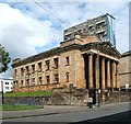
St George's in the Fields
High flats at Cedar Court are behind the building.
See Image, another contributor's earlier picture, for links to more views of the former church, and for further information.
Image: © Lairich Rig
Taken: 19 Jul 2011
0.09 miles
10

St George's in the Fields
For a picture of the whole building, taken on the same day, see Image
For more information about the sculpted tympanum, see Image, another contributor's earlier photograph, which also has links to other views.
Image: © Lairich Rig
Taken: 19 Jul 2011
0.09 miles