
IMAGES TAKEN NEAR TO
Woodlands Road, GLASGOW, G46 7SE
Introduction
This page details the photographs taken nearby to Woodlands Road, G46 7SE by members of the Geograph project.
The Geograph project started in 2005 with the aim of publishing, organising and preserving representative images for every square kilometre of Great Britain, Ireland and the Isle of Man.

There are currently over 7.5m images from over14,400 individuals and you can help contribute to the project by visiting https://www.geograph.org.uk
Image Map
Images are licensed for reuse under creativecommons.org/licenses/by-sa/2.0
Notes
- Clicking on the map will re-center to the selected point.
- The higher the marker number, the further away the image location is from the centre of the postcode.
Image Listing (24 Images Found)
Images are licensed for reuse under creativecommons.org/licenses/by-sa/2.0
Image
Details
Distance
1
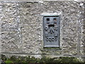
Ordnance Survey Flush Bracket G201
This can be found on the wall of the former Woodlands parish Church - now private apartments.
For more detail see : http://www.bench-marks.org.uk/bm16861
Image: © Peter Wood
Taken: 14 Sep 2016
0.01 miles
2
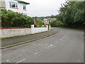
Woodlands Crescent at Thornliebank
Looking southward.
Image: © Peter Wood
Taken: 14 Sep 2016
0.03 miles
3
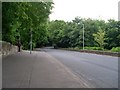
Country road feel to main city road
Spiersbridge Road in Glasgow.
Image: © Stephen Sweeney
Taken: 13 Jun 2009
0.05 miles
4

Spiersbridge Business Park, Thornliebank
Image: © Richard Webb
Taken: 28 Sep 2025
0.12 miles
6

Spiersbridge Business Park, Thornliebank
Site of a dye works. There was a chimney sited where the trees are now.
Image: © Richard Webb
Taken: 28 Sep 2025
0.13 miles
7

Thornliebank Playing Fields
Once fields around Crosslees House, the area has avoided industrial and housing use and is now a small park.
Image: © Richard Webb
Taken: 28 Sep 2025
0.15 miles
8
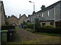
Housing at Rouken Glen Road
Bell tower is on Thornliebank Parish Church.
Image: © Alan Reid
Taken: 5 Nov 2018
0.15 miles
9

Thornliebank Community Library
At the point where Main Street (B769) in Thornliebank has become Spiersbridge Road, still the B769.
Image: © G Laird
Taken: 30 Oct 2013
0.15 miles
10
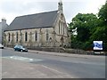
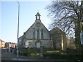
Thornliebank Parish Church
At the corner of Spiersbridge Road and Rouken Glen Road.
Image: © Stephen Sweeney
Taken: 13 Jun 2009
0.15 miles