
IMAGES TAKEN NEAR TO
Evan Drive, GLASGOW, G46 6NN
Introduction
This page details the photographs taken nearby to Evan Drive, G46 6NN by members of the Geograph project.
The Geograph project started in 2005 with the aim of publishing, organising and preserving representative images for every square kilometre of Great Britain, Ireland and the Isle of Man.

There are currently over 7.5m images from over14,400 individuals and you can help contribute to the project by visiting https://www.geograph.org.uk
Image Map
Images are licensed for reuse under creativecommons.org/licenses/by-sa/2.0
Notes
- Clicking on the map will re-center to the selected point.
- The higher the marker number, the further away the image location is from the centre of the postcode.
Image Listing (14 Images Found)
Images are licensed for reuse under creativecommons.org/licenses/by-sa/2.0
Image
Details
Distance
1
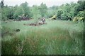
The Williamswood Triangle
The triangle is formed by three railway lines - one dismantled, the other two still in use. The ground in between is undisturbed, and as a result it is a good area for wildlife.
This visit involved getting special permission from the railway authorities for access to the site to record what species of wildlife were present - hence the hi-vis jacket.
Image: © Richard Sutcliffe
Taken: Unknown
0.13 miles

4
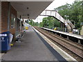
Williamwood railway station, looking South-West
View from platform 2 at Williamwood railway station, looking roughly South-West towards Neilston.
Image: © Andrew Reid
Taken: 2 Sep 2011
0.22 miles
5
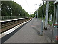
Williamwood railway station, looking North-East
View from platform 2 at Williamwood railway station, looking roughly North-East towards Glasgow Central.
Image: © Andrew Reid
Taken: 2 Sep 2011
0.22 miles
6
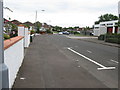
Dorian Drive, Williamwood
Looking roughly ENE along a section of Dorian Drive, Williamwood.
Image: © Andrew Reid
Taken: 2 Sep 2011
0.22 miles
7
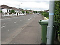
Dorian Drive, Williamwood
Looking roughly WSW along a section of Dorian Drive, Williamwood.
Image: © Andrew Reid
Taken: 2 Sep 2011
0.22 miles
8
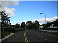
West end of Drumby Crescent, Williamwood
Off Eastwoodmains Road.
Image: © Richard Vince
Taken: 12 Sep 2022
0.24 miles
10
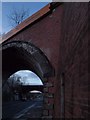
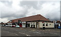
Williamwood railway bridges at dusk
The bridge looming in the foreground, also shown in Image, is disused. The more distant bridge carries the railway line coming from Muirend train station (Image). The picture looks west along Eastwoodmains Road.
Image: © Alec MacKinnon
Taken: 31 Dec 2012
0.25 miles