IMAGES TAKEN NEAR TO
Stoneside Drive, GLASGOW, G43 1JG
Introduction
This page details the photographs taken nearby to Stoneside Drive, G43 1JG by members of the Geograph project.
The Geograph project started in 2005 with the aim of publishing, organising and preserving representative images for every square kilometre of Great Britain, Ireland and the Isle of Man.

There are currently over 7.5m images from over14,400 individuals and you can help contribute to the project by visiting https://www.geograph.org.uk
Image Map
Images are licensed for reuse under creativecommons.org/licenses/by-sa/2.0
Notes
- Clicking on the map will re-center to the selected point.
- The higher the marker number, the further away the image location is from the centre of the postcode.
Image Listing (17 Images Found)
Images are licensed for reuse under creativecommons.org/licenses/by-sa/2.0
Image
Details
Distance
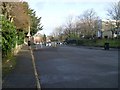
1
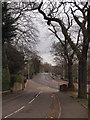
Thornliebank Road from Mansewood Road
The very short street in the foreground links Mansewood Road and Thornliebank Road, which recedes into the distance. We look from Mansewood Road. At any other, non-lockdown time, Thornliebank Road would be very busy with traffic on a Saturday morning.
Image: © Alec MacKinnon
Taken: 4 Apr 2020
0.07 miles
2
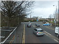
Thornliebank Road
Approaching the junction south of Pollokshaws roundabout.
Image: © Barbara Carr
Taken: 22 Apr 2013
0.11 miles
3
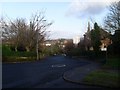
Mansewood Road
Beautiful suburban area in the south of Glasgow.
Image: © Stephen Sweeney
Taken: 25 Feb 2009
0.12 miles
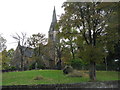
4
Mansewood Road at Eastwood Parish Church
The church is seen here from uphill on Mansewood Road, with traffic calming measures in the foreground.
Image: © Alec MacKinnon
Taken: 4 Apr 2020
0.12 miles
7
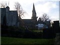
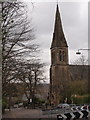
Eastwood Parish Church
Undergoing some maintenance work to the spire.
Image: © Stephen Sweeney
Taken: 25 Feb 2009
0.14 miles
8
Eastwood Parish Church
Church of Scotland on Mansewood Road near the fork in the road with Thornliebank Road.
Image: © G Laird
Taken: 30 Oct 2013
0.14 miles
9
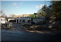
Traffic calming scheme on Mansewood Road
Outside Hillpark Secondary School.
Image: © Stephen Sweeney
Taken: 25 Feb 2009
0.18 miles
10
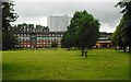
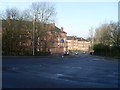
Greenbank Park
Looking towards Harriet Place, a long five-storey terrace of flats, dating from the 1970s. Behind are the only surviving high rise flats in the Pollokshaws area, at 33 Cartcraigs Road.
Image: © Richard Sutcliffe
Taken: 7 Jul 2017
0.18 miles